Prairie Village night lights from space
Night Light of Prairie Village (Kansas) from space (United States) Src. Average luminocity for 10x10km area is 94.6347% and for 50x50km: 67.7528%.
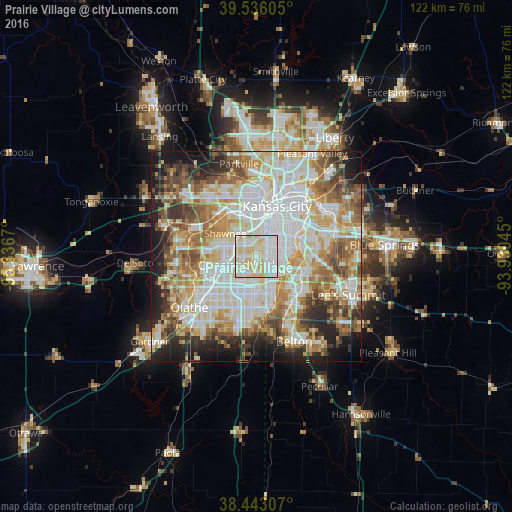
Analysis of Prairie Village night lights 2016
Square area 10x10 km:
 36.69%
90-99
35.06%80-89
28.08%70-79
0.16%60-69
0%50-59
0%40-49
0%30-39
0%20-29
0%10-19
0%0-9
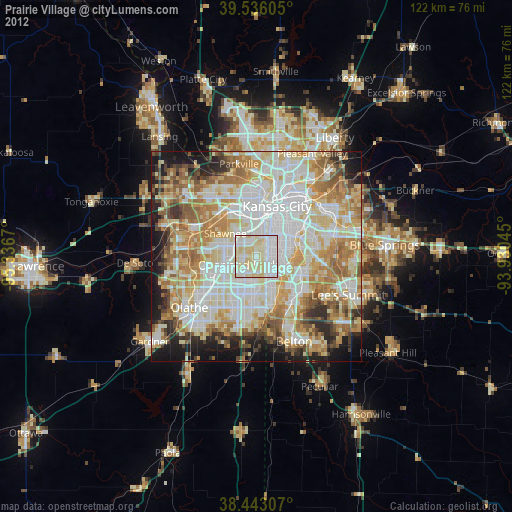
0%Square area 50x50 km:
18.94%90-99
17.92%80-89
9.79%70-79
7.73%60-69
8.96%50-59
7.53%40-49
6.06%30-39
5.5%20-29
6.65%10-19
8.3%0-9
2.6%Clear (daylight) street map image can be seen on geolist.org.
Map coordinates:
39° 32' 9.8" North, 95° 20' 12.1" West
38° 59' 30" North, 94° 38' 0.9" West
38° 26' 35.1" North, 93° 55' 49.6" West
Some cities around Prairie Village sort by population:
• Kansas City
12.9 km =8 mi,  21°
21°
• Overland Park
3.4 km =2.1 mi,  251°
251°
• Shawnee
9.3 km =5.8 mi,  306°
306°
• Lenexa
9.6 km =6 mi,  243°
243°
• Leawood
3.1 km =1.9 mi,  152°
152°
• Merriam
6.3 km =3.9 mi,  304°
304°
• Mission
4.5 km =2.8 mi,  334°
334°
• Roeland Park
5.1 km =3.2 mi,  1°
1°
4277718 (p: 21,877)
Sources (retrieved 2019-11-25):
» Earth at Night: Flat Maps 2012, 2016