Mission District night lights from space
Night Light of Mission District (California) from space (United States) Src. Average luminocity for 10x10km area is 89.7789% and for 50x50km: 34.0988%.
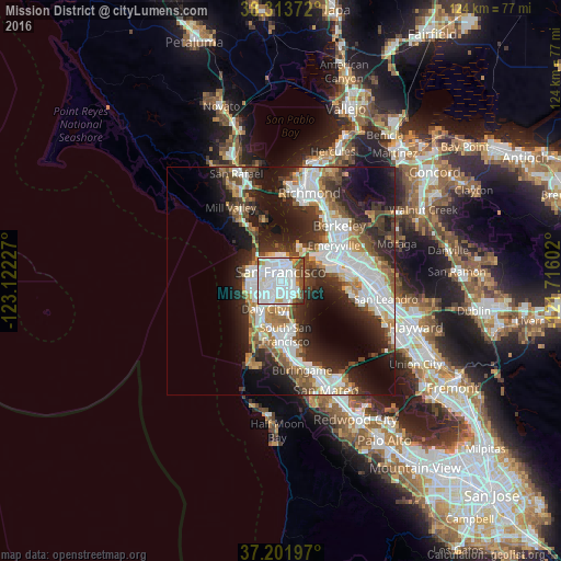

Analysis of Mission District night lights 2016
Square area 10x10 km:
 53.06%
90-99
23.81%80-89
1.7%70-79
3.91%60-69
2.21%50-59
8.5%40-49
5.44%30-39
0.85%20-29
0.51%10-19
0%0-9
0%Square area 50x50 km:
9.19%90-99
7.47%80-89
1.97%70-79
3.55%60-69
3.8%50-59
4.04%40-49
4.81%30-39
4.93%20-29
9.57%10-19
13.32%0-9
37.35%Clear (daylight) street map image can be seen on geolist.org.
Map coordinates:
38° 18' 49.4" North, 123° 7' 20.2" West
37° 45' 35.7" North, 122° 25' 8.9" West
37° 12' 7.1" North, 121° 42' 57.7" West
Some cities around Mission District sort by population:
• San Francisco
1.7 km =1.1 mi,  359°
359°
• Daly City
7.1 km =4.4 mi,  211°
211°
• Chinatown
4.2 km =2.6 mi,  12°
12°
• South San Francisco
11.7 km =7.3 mi,  175°
175°
• Noe Valley
1.7 km =1.1 mi,  229°
229°
• Visitacion Valley
4.9 km =3 mi,  164°
164°
• Tiburon
13.1 km =8.1 mi,  345°
345°
• Sausalito
12.5 km =7.8 mi,  332°
332°
5373628 (p: 47,234)
Sources (retrieved 2019-11-25):
» Earth at Night: Flat Maps 2012, 2016