Daly City night lights from space
Night Light of Daly City (California) from space (United States) Src. Average luminocity for 10x10km area is 76.3656% and for 50x50km: 29.617%.

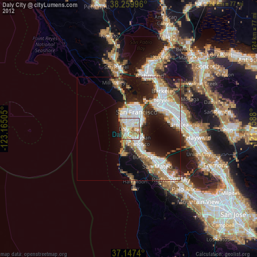
Analysis of Daly City night lights 2016
Square area 10x10 km:
 26.53%
90-99
21.09%80-89
3.74%70-79
14.8%60-69
14.12%50-59
1.7%40-49
2.04%30-39
2.72%20-29
11.05%10-19
2.21%0-9
0%Square area 50x50 km:
8.12%90-99
6.47%80-89
1.51%70-79
3.26%60-69
3.26%50-59
3.99%40-49
4.06%30-39
3.9%20-29
7.93%10-19
10.78%0-9
46.7%Clear (daylight) street map image can be seen on geolist.org.
Map coordinates:
38° 15' 35.9" North, 123° 9' 54.2" West
37° 42' 20.8" North, 122° 27' 42.9" West
37° 8' 50.6" North, 121° 45' 31.7" West
Some cities around Daly City sort by population:
• San Francisco
8.5 km =5.3 mi,  25°
25°
• Chinatown
11.1 km =6.9 mi,  24°
24°
• South San Francisco
7.4 km =4.6 mi,  140°
140°
• Mission District
7.1 km =4.4 mi, 31°
• San Bruno
9.5 km =5.9 mi,  151°
151°
• Pacifica
10.5 km =6.5 mi,  192°
192°
• Noe Valley
5.5 km =3.4 mi, 26°
• Visitacion Valley
5.2 km =3.2 mi,  75°
75°
5341430 (p: 106,562)
Sources (retrieved 2019-11-25):
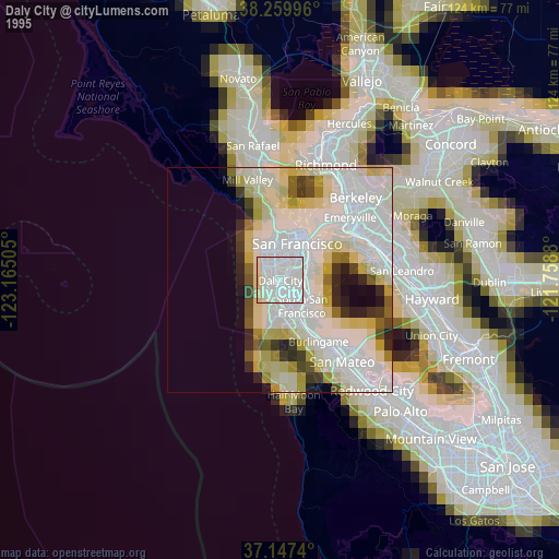
» NASA, Earths city lights 1995
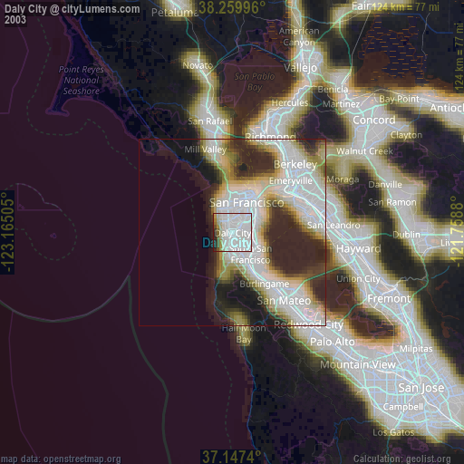
» NASA city lights 2003
» Earth at Night: Flat Maps 2012, 2016