Visitacion Valley night lights from space
Night Light of Visitacion Valley (California) from space (United States) Src. Average luminocity for 10x10km area is 72.7177% and for 50x50km: 34.3296%.
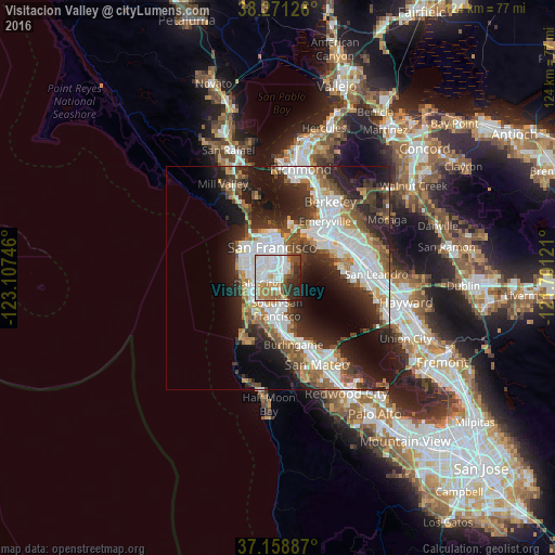
Analysis of Visitacion Valley night lights 2016
Square area 10x10 km:
 28.06%
90-99
18.54%80-89
3.91%70-79
6.8%60-69
11.22%50-59
6.29%40-49
4.76%30-39
6.46%20-29
10.37%10-19
3.57%0-9
0%Square area 50x50 km:
9.16%90-99
7.43%80-89
1.76%70-79
3.65%60-69
3.85%50-59
4.51%40-49
4.95%30-39
4.94%20-29
9.89%10-19
12.75%0-9
37.11%Clear (daylight) street map image can be seen on geolist.org.
Map coordinates:
38° 16' 16.5" North, 123° 6' 26.9" West
37° 43' 1.7" North, 122° 24' 15.6" West
37° 9' 31.9" North, 121° 42' 4.4" West
Some cities around Visitacion Valley sort by population:
• San Francisco
6.6 km =4.1 mi,  348°
348°
• Daly City
5.2 km =3.2 mi,  255°
255°
• Chinatown
8.8 km =5.5 mi,  357°
357°
• South San Francisco
7 km =4.3 mi,  182°
182°
• Mission District
4.9 km =3 mi,  344°
344°
• San Bruno
9.7 km =6 mi, 183°
• Noe Valley
4.5 km =2.8 mi,  324°
324°
• Millbrae
13.3 km =8.3 mi,  173°
173°
8449777 (p: 22,534)
Sources (retrieved 2019-11-25):
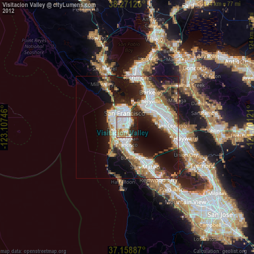
» Earth at Night: Flat Maps 2012, 2016