South San Francisco night lights from space
Night Light of South San Francisco (California) from space (United States) Src. Average luminocity for 10x10km area is 69.3265% and for 50x50km: 32.9502%.
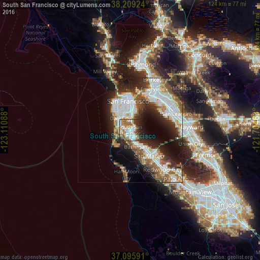

Analysis of South San Francisco night lights 2016
Square area 10x10 km:
 18.37%
90-99
17.01%80-89
5.1%70-79
8.67%60-69
15.99%50-59
11.05%40-49
4.25%30-39
7.14%20-29
10.88%10-19
1.53%0-9
0%Square area 50x50 km:
8.95%90-99
7.24%80-89
1.71%70-79
3.65%60-69
4.14%50-59
4.56%40-49
4.5%30-39
4.1%20-29
8.27%10-19
10.36%0-9
42.54%Clear (daylight) street map image can be seen on geolist.org.
Map coordinates:
38° 12' 33.3" North, 123° 6' 39.2" West
37° 39' 16.8" North, 122° 24' 27.9" West
37° 5' 45.3" North, 121° 42' 16.7" West
Some cities around South San Francisco sort by population:
• Daly City
7.4 km =4.6 mi,  320°
320°
• San Bruno
2.7 km =1.7 mi,  186°
186°
• Pacifica
8.3 km =5.2 mi,  236°
236°
• Burlingame
8.7 km =5.4 mi,  154°
154°
• Noe Valley
10.9 km =6.8 mi,  347°
347°
• Millbrae
6.5 km =4 mi,  163°
163°
• Visitacion Valley
7 km =4.3 mi,  2°
2°
• Hillsborough
9.3 km =5.8 mi, 164°
5397765 (p: 67,271)
Sources (retrieved 2019-11-25):
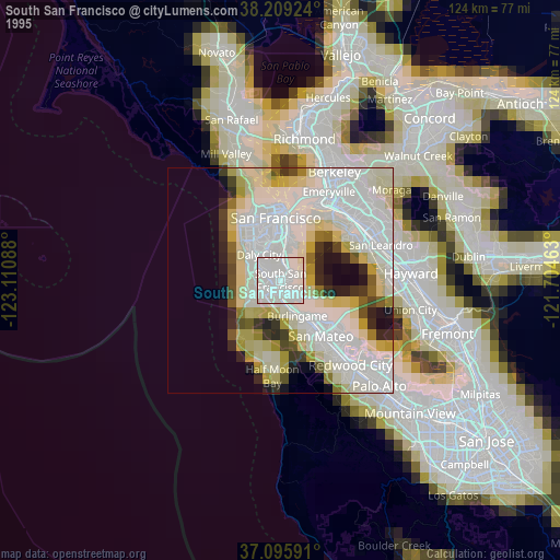
» NASA, Earths city lights 1995
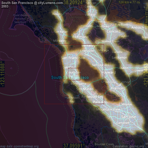
» NASA city lights 2003
» Earth at Night: Flat Maps 2012, 2016