Alexander City night lights from space
Night Light of Alexander City (Alabama) from space (United States) Src. Average luminocity for 10x10km area is 46.7656% and for 50x50km: 4.3283%.
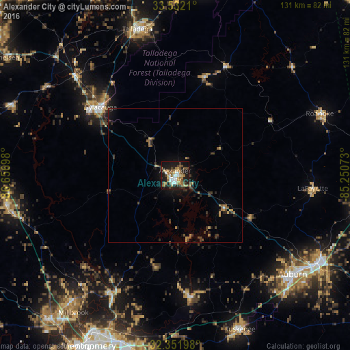
Analysis of Alexander City night lights 2016
Square area 10x10 km:
 7.14%
7.14%90-99
6.78%80-89
6.59%70-79
7.14%60-69
11.17%50-59
4.95%40-49
6.78%30-39
5.31%20-29
13.55%10-19
28.75%0-9
1.83%Square area 50x50 km:
0.31%90-99
0.27%80-89
0.5%70-79
0.66%60-69
0.77%50-59
0.53%40-49
0.77%30-39
1%20-29
1.2%10-19
3.08%0-9
90.9%Clear (daylight) street map image can be seen on geolist.org.
Map coordinates:
33° 31' 55.6" North, 86° 39' 25.1" West
32° 56' 38.4" North, 85° 57' 13.9" West
32° 21' 7.1" North, 85° 15' 2.6" West
Some cities around Alexander City sort by population:
• Auburn
57.8 km =35.9 mi,  130°
130°
• Opelika
63.2 km =39.3 mi,  121°
121°
• Talladega
56.5 km =35.1 mi,  345°
345°
• Sylacauga
37.7 km =23.4 mi,  312°
312°
• Tuskegee
62.8 km =39 mi,  156°
156°
• Wetumpka
50.6 km =31.4 mi,  208°
208°
• Roanoke
58.9 km =36.6 mi,  66°
66°
• Childersburg
52.7 km =32.7 mi, 314°
4829843 (p: 14,718)
Sources (retrieved 2019-11-25):
» Earth at Night: Flat Maps 2012, 2016