Tuskegee night lights from space
Night Light of Tuskegee (Alabama) from space (United States) Src. Average luminocity for 10x10km area is 39.3278% and for 50x50km: 9.7956%.
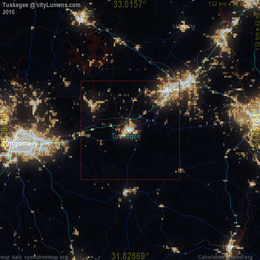
Analysis of Tuskegee night lights 2016
Square area 10x10 km:
 2.75%
2.75%90-99
4.76%80-89
9.89%70-79
8.42%60-69
7.14%50-59
3.3%40-49
0.92%30-39
9.34%20-29
5.86%10-19
36.63%0-9
10.99%Square area 50x50 km:
0.92%90-99
1.07%80-89
1.38%70-79
1.54%60-69
1.96%50-59
0.96%40-49
1.62%30-39
2.22%20-29
2.08%10-19
6.08%0-9
80.17%Clear (daylight) street map image can be seen on geolist.org.
Map coordinates:
33° 0' 56.5" North, 86° 23' 38.7" West
32° 25' 26.9" North, 85° 41' 27.5" West
31° 49' 43.3" North, 84° 59' 16.2" West
Some cities around Tuskegee sort by population:
• Montgomery
57.5 km =35.7 mi,  263°
263°
• Auburn
28.5 km =17.7 mi,  43°
43°
• Opelika
38.3 km =23.8 mi,  49°
49°
• Millbrook
63.3 km =39.3 mi,  275°
275°
• Alexander City
62.8 km =39 mi,  336°
336°
• Pike Road
41.7 km =25.9 mi,  248°
248°
• Wetumpka
50.6 km =31.4 mi,  285°
285°
• Smiths Station
57 km =35.4 mi,  76°
76°
4094490 (p: 8,817)
Sources (retrieved 2019-11-25):
» Earth at Night: Flat Maps 2012, 2016