Milford night lights from space
Night Light of Milford (New Hampshire) from space (United States) Src. Average luminocity for 10x10km area is 18.4508% and for 50x50km: 15.2056%.
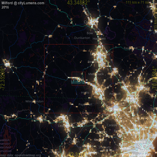
Analysis of Milford night lights 2016
Square area 10x10 km:
 1.27%
1.27%90-99
2.22%80-89
3.33%70-79
0.79%60-69
3.17%50-59
3.33%40-49
3.65%30-39
2.22%20-29
1.59%10-19
8.1%0-9
70.32%Square area 50x50 km:
1.81%90-99
2.46%80-89
1.67%70-79
1.89%60-69
1.89%50-59
2.34%40-49
2.61%30-39
2.72%20-29
5.67%10-19
10.08%0-9
66.85%Clear (daylight) street map image can be seen on geolist.org.
Map coordinates:
43° 20' 55.8" North, 72° 21' 7.5" West
42° 50' 7.3" North, 71° 38' 56.3" West
42° 19' 3.4" North, 70° 56' 45" West
Some cities around Milford sort by population:
• Nashua
16.7 km =10.4 mi,  117°
117°
• Merrimack
13.1 km =8.1 mi,  75°
75°
• Bedford
16.4 km =10.2 mi,  41°
41°
• Londonderry
22.7 km =14.1 mi, 81°
• Litchfield
13.8 km =8.6 mi,  85°
85°
• Hollis
11.3 km =7 mi,  155°
155°
• Hudson
18.8 km =11.7 mi,  114°
114°
• New Ipswich
19.4 km =12.1 mi,  239°
239°
5089578 (p: 8,835)
Sources (retrieved 2019-11-25):
» Earth at Night: Flat Maps 2012, 2016