Londonderry night lights from space
Night Light of Londonderry (New Hampshire) from space (United States) Src. Average luminocity for 10x10km area is 32.2159% and for 50x50km: 26.7406%.
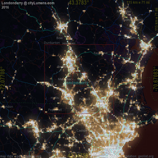
Analysis of Londonderry night lights 2016
Square area 10x10 km:
 4.29%
4.29%90-99
4.92%80-89
2.54%70-79
4.29%60-69
4.29%50-59
1.59%40-49
5.24%30-39
2.86%20-29
15.4%10-19
51.27%0-9
3.33%Square area 50x50 km:
3.3%90-99
4.4%80-89
2.99%70-79
3.21%60-69
3.82%50-59
5.01%40-49
5.06%30-39
4.68%20-29
8.84%10-19
15.09%0-9
43.6%Clear (daylight) street map image can be seen on geolist.org.
Map coordinates:
43° 22' 41.9" North, 72° 4' 37.5" West
42° 51' 54.3" North, 71° 22' 26.2" West
42° 20' 51.3" North, 70° 40' 15" West
Some cities around Londonderry sort by population:
• Nashua
13.5 km =8.4 mi,  214°
214°
• Derry Village
5.9 km =3.7 mi,  59°
59°
• Merrimack
9.7 km =6 mi,  270°
270°
• Derry
4.2 km =2.6 mi,  65°
65°
• Windham
9.1 km =5.7 mi,  141°
141°
• Litchfield
8.9 km =5.5 mi,  254°
254°
• Hudson
12.4 km =7.7 mi, 205°
• Chester
13.9 km =8.6 mi,  42°
42°
5088905 (p: 11,037)
Sources (retrieved 2019-11-25):
» Earth at Night: Flat Maps 2012, 2016