Nashua night lights from space
Night Light of Nashua (New Hampshire) from space (United States) Src. Average luminocity for 10x10km area is 64.197% and for 50x50km: 28.3082%.
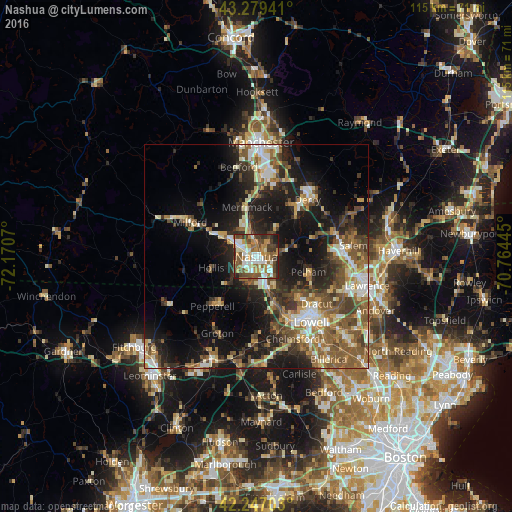
Analysis of Nashua night lights 2016
Square area 10x10 km:
 12.27%
90-99
13.94%80-89
3.48%70-79
15.15%60-69
8.64%50-59
13.94%40-49
13.18%30-39
8.48%20-29
8.79%10-19
2.12%0-9
0%Square area 50x50 km:
3.35%90-99
4.47%80-89
3.13%70-79
3.32%60-69
4.49%50-59
6.59%40-49
4.97%30-39
4.62%20-29
8.25%10-19
16.08%0-9
40.72%Clear (daylight) street map image can be seen on geolist.org.
Map coordinates:
43° 16' 45.9" North, 72° 10' 14.5" West
42° 45' 55.3" North, 71° 28' 3.3" West
42° 14' 49.3" North, 70° 45' 52" West
Some cities around Nashua sort by population:
• Merrimack
11.3 km =7 mi,  349°
349°
• Windham
13.9 km =8.6 mi,  73°
73°
• Pelham
12.2 km =7.6 mi,  106°
106°
• Tyngsboro
10.5 km =6.5 mi,  160°
160°
• Londonderry
13.5 km =8.4 mi,  34°
34°
• Litchfield
8.8 km =5.5 mi, 353°
• Hollis
10.4 km =6.5 mi,  256°
256°
• Hudson
2.3 km =1.4 mi,  91°
91°
5090046 (p: 87,970)
Sources (retrieved 2019-11-25):
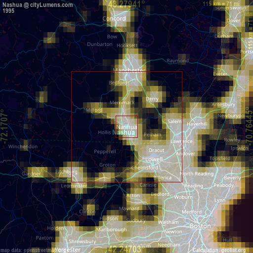
» NASA, Earths city lights 1995
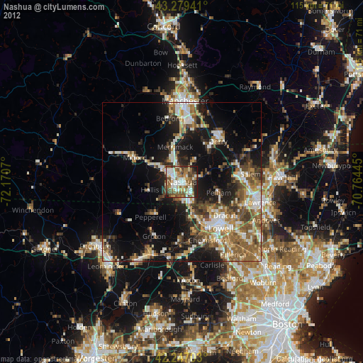
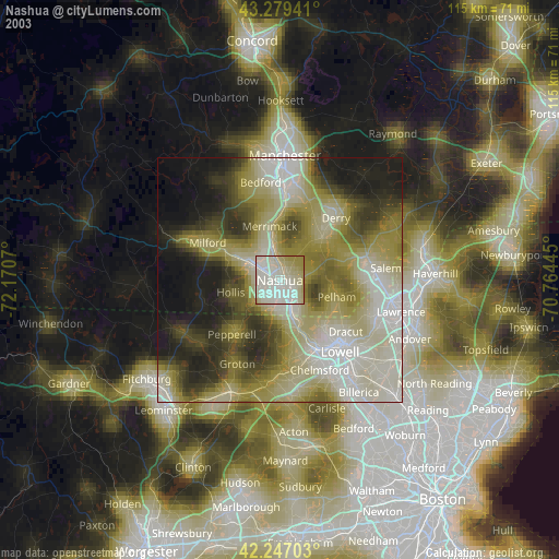
» NASA city lights 2003
» Earth at Night: Flat Maps 2012, 2016