Milford night lights from space
Night Light of Milford (Massachusetts) from space (United States) Src. Average luminocity for 10x10km area is 41.5576% and for 50x50km: 39.1147%.
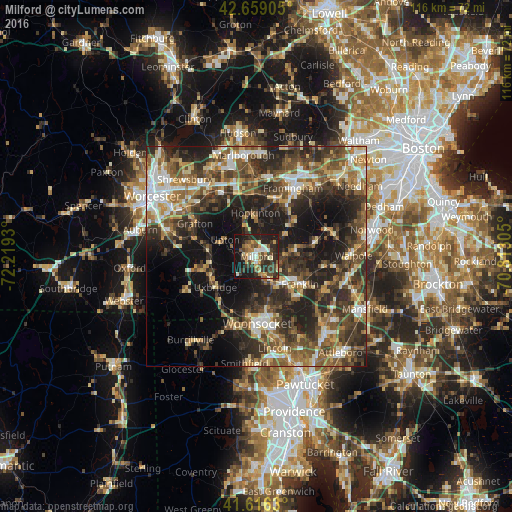

Analysis of Milford night lights 2016
Square area 10x10 km:
 2.58%
2.58%90-99
7.58%80-89
4.55%70-79
7.42%60-69
3.79%50-59
6.67%40-49
8.48%30-39
11.21%20-29
19.24%10-19
25.76%0-9
2.73%Square area 50x50 km:
4.22%90-99
5.84%80-89
4.91%70-79
4.43%60-69
6.3%50-59
7.72%40-49
8.71%30-39
9.49%20-29
14.5%10-19
15.69%0-9
18.18%Clear (daylight) street map image can be seen on geolist.org.
Map coordinates:
42° 39' 32.6" North, 72° 13' 9.5" West
42° 8' 23.4" North, 71° 30' 58.2" West
41° 36' 58.7" North, 70° 48' 47" West
Some cities around Milford sort by population:
• Franklin
11.7 km =7.3 mi,  122°
122°
• Northbridge
11.1 km =6.9 mi,  276°
276°
• Holliston
10.1 km =6.3 mi,  48°
48°
• Medway
9.8 km =6.1 mi,  88°
88°
• Uxbridge
11.6 km =7.2 mi,  233°
233°
• Millis
13.4 km =8.3 mi,  76°
76°
• Whitinsville
12.8 km =8 mi,  255°
255°
• Mendon
4.8 km =3 mi,  218°
218°
4943958 (p: 25,055)
Sources (retrieved 2019-11-25):
» Earth at Night: Flat Maps 2012, 2016