Mendon night lights from space
Night Light of Mendon (Massachusetts) from space (United States) Src. Average luminocity for 10x10km area is 27.1258% and for 50x50km: 36.9255%.
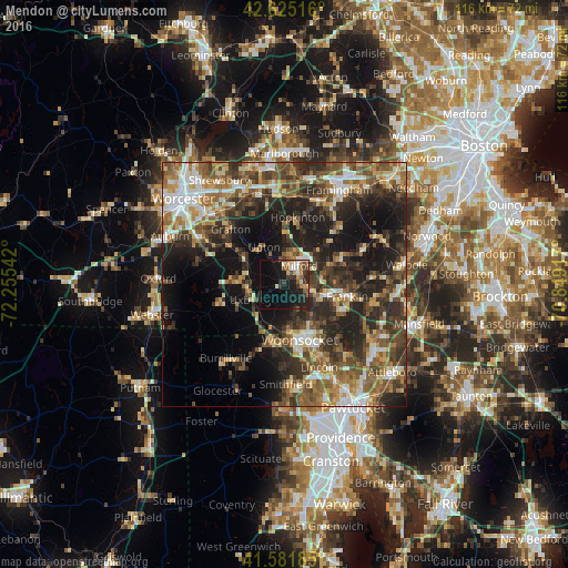
Analysis of Mendon night lights 2016
Square area 10x10 km:
 1.82%
1.82%90-99
3.79%80-89
2.42%70-79
4.39%60-69
3.03%50-59
3.79%40-49
3.18%30-39
5.61%20-29
10.3%10-19
30.15%0-9
31.52%Square area 50x50 km:
4.22%90-99
5.63%80-89
4.48%70-79
4.35%60-69
6.16%50-59
7.29%40-49
7.52%30-39
8.17%20-29
12.62%10-19
16.51%0-9
23.05%Clear (daylight) street map image can be seen on geolist.org.
Map coordinates:
42° 37' 30.6" North, 72° 15' 19.5" West
42° 6' 20.3" North, 71° 33' 8.2" West
41° 34' 54.7" North, 70° 50' 57" West
Some cities around Mendon sort by population:
• Woonsocket
11.8 km =7.3 mi,  164°
164°
• Franklin
13.1 km =8.1 mi,  100°
100°
• Milford
4.8 km =3 mi,  38°
38°
• Northbridge
9.5 km =5.9 mi,  302°
302°
• Medway
13.4 km =8.3 mi,  72°
72°
• Uxbridge
7.1 km =4.4 mi,  243°
243°
• Blackstone
9.8 km =6.1 mi,  174°
174°
• Whitinsville
9.4 km =5.8 mi,  273°
273°
4943746 (p: 5,378)
Sources (retrieved 2019-11-25):
» Earth at Night: Flat Maps 2012, 2016