Franklin night lights from space
Night Light of Franklin (Massachusetts) from space (United States) Src. Average luminocity for 10x10km area is 42.8561% and for 50x50km: 42.634%.
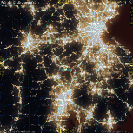
Analysis of Franklin night lights 2016
Square area 10x10 km:
 3.03%
3.03%90-99
5.91%80-89
5.76%70-79
2.88%60-69
3.94%50-59
8.94%40-49
8.03%30-39
22.73%20-29
28.18%10-19
10.61%0-9
0%Square area 50x50 km:
5.31%90-99
6.44%80-89
4.69%70-79
4.83%60-69
7.05%50-59
8.83%40-49
9.13%30-39
9.85%20-29
15.54%10-19
16.71%0-9
11.61%Clear (daylight) street map image can be seen on geolist.org.
Map coordinates:
42° 36' 11.2" North, 72° 5' 59.5" West
42° 5' 0.3" North, 71° 23' 48.2" West
41° 33' 34" North, 70° 41' 37" West
Some cities around Franklin sort by population:
• Milford
11.7 km =7.3 mi,  302°
302°
• Medway
6.5 km =4 mi,  0°
0°
• Wrentham
6 km =3.7 mi,  108°
108°
• Norfolk
7.1 km =4.4 mi,  55°
55°
• Millis
9.9 km =6.2 mi,  18°
18°
• Plainville
10.3 km =6.4 mi,  149°
149°
• Foxborough
12.5 km =7.8 mi,  99°
99°
• Mendon
13.1 km =8.1 mi,  280°
280°
4937276 (p: 30,636)
Sources (retrieved 2019-11-25):
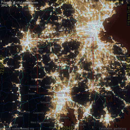
» Earth at Night: Flat Maps 2012, 2016