Northbridge night lights from space
Night Light of Northbridge (Massachusetts) from space (United States) Src. Average luminocity for 10x10km area is 21.1394% and for 50x50km: 34.3864%.
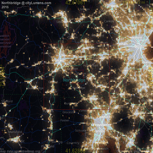
Analysis of Northbridge night lights 2016
Square area 10x10 km:
 0.45%
0.45%90-99
1.06%80-89
2.12%70-79
2.42%60-69
3.64%50-59
3.48%40-49
2.58%30-39
5%20-29
8.79%10-19
33.79%0-9
36.67%Square area 50x50 km:
3.84%90-99
5.07%80-89
4.39%70-79
3.88%60-69
5.09%50-59
6.11%40-49
6.6%30-39
7.38%20-29
13.53%10-19
18.97%0-9
25.13%Clear (daylight) street map image can be seen on geolist.org.
Map coordinates:
42° 40' 14.2" North, 72° 21' 9.5" West
42° 9' 5.3" North, 71° 38' 58.2" West
41° 37' 41" North, 70° 56' 47" West
Some cities around Northbridge sort by population:
• Milford
11.1 km =6.9 mi,  96°
96°
• Grafton
6.9 km =4.3 mi,  334°
334°
• Millbury
10.3 km =6.4 mi,  297°
297°
• Uxbridge
8.4 km =5.2 mi,  168°
168°
• Sutton
9.3 km =5.8 mi,  269°
269°
• Douglas
13.1 km =8.1 mi,  214°
214°
• Whitinsville
4.7 km =2.9 mi,  197°
197°
• Mendon
9.5 km =5.9 mi,  122°
122°
4945848 (p: 14,061)
Sources (retrieved 2019-11-25):
» Earth at Night: Flat Maps 2012, 2016