McKees Rocks night lights from space
Night Light of McKees Rocks (Pennsylvania) from space (United States) Src. Average luminocity for 10x10km area is 88.0221% and for 50x50km: 52.5518%.
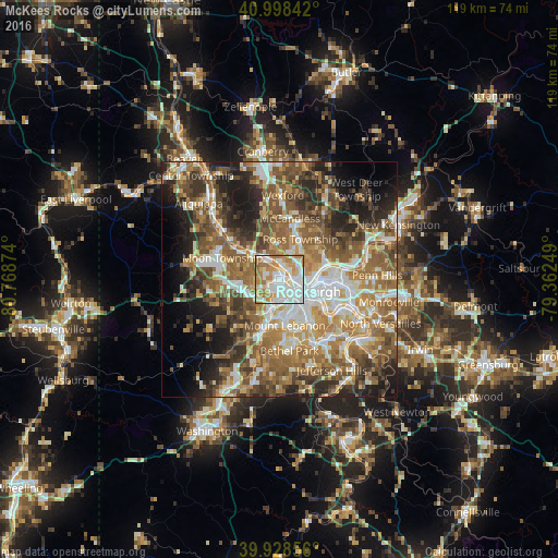
Analysis of McKees Rocks night lights 2016
Square area 10x10 km:
 29.59%
90-99
28.06%80-89
10.88%70-79
15.48%60-69
14.46%50-59
1.53%40-49
0%30-39
0%20-29
0%10-19
0%0-9
0%Square area 50x50 km:
8.5%90-99
9.7%80-89
6.16%70-79
7.74%60-69
10.85%50-59
11.77%40-49
9.11%30-39
6.69%20-29
9.06%10-19
9.18%0-9
11.24%Clear (daylight) street map image can be seen on geolist.org.
Map coordinates:
40° 59' 54.3" North, 80° 46' 7.5" West
40° 27' 56.2" North, 80° 3' 56.2" West
39° 55' 42.8" North, 79° 21' 45" West
Some cities around McKees Rocks sort by population:
• Pittsburgh
6.5 km =4 mi,  115°
115°
• Glenshaw
11.2 km =7 mi,  47°
47°
• Dormont
8.2 km =5.1 mi,  160°
160°
• Bellevue
3.4 km =2.1 mi,  20°
20°
• Carnegie
6.5 km =4 mi,  193°
193°
• West View
6.8 km =4.2 mi, 22°
• Crafton
3.4 km =2.1 mi,  180°
180°
• Coraopolis
10.4 km =6.5 mi,  304°
304°
5200474 (p: 6,010)
Sources (retrieved 2019-11-25):
» Earth at Night: Flat Maps 2012, 2016