Pittsburgh night lights from space
Night Light of Pittsburgh (Pennsylvania) from space (United States) Src. Average luminocity for 10x10km area is 95.9626% and for 50x50km: 55.9398%.
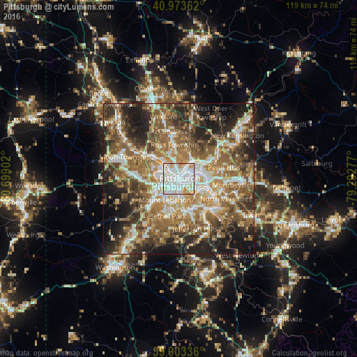
Analysis of Pittsburgh night lights 2016
Square area 10x10 km:
 53.23%
90-99
29.76%80-89
10.03%70-79
5.61%60-69
1.36%50-59
0%40-49
0%30-39
0%20-29
0%10-19
0%0-9
0%Square area 50x50 km:
8.89%90-99
10.08%80-89
6.61%70-79
8.02%60-69
11.39%50-59
12.72%40-49
10.15%30-39
7.74%20-29
10.82%10-19
10.17%0-9
3.41%Clear (daylight) street map image can be seen on geolist.org.
Map coordinates:
40° 58' 25" North, 80° 41' 56.5" West
40° 26' 26.2" North, 79° 59' 45.2" West
39° 54' 12.1" North, 79° 17' 34" West
Some cities around Pittsburgh sort by population:
• Whitehall
8.8 km =5.5 mi,  177°
177°
• Brentwood
8 km =5 mi,  167°
167°
• Dormont
5.9 km =3.7 mi,  212°
212°
• Bellevue
7.6 km =4.7 mi,  321°
321°
• Castle Shannon
8.7 km =5.4 mi,  194°
194°
• Carnegie
8.2 km =5.1 mi,  244°
244°
• McKees Rocks
6.5 km =4 mi,  295°
295°
• Crafton
6 km =3.7 mi,  264°
264°
5206379 (p: 304,391)
Sources (retrieved 2019-11-25):
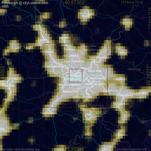
» NASA, Earths city lights 1995
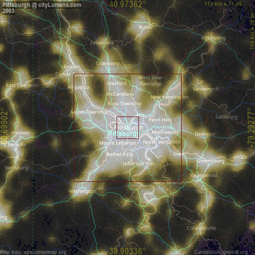
» NASA city lights 2003
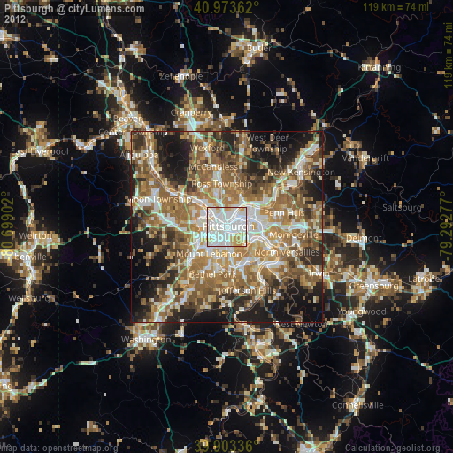
» Earth at Night: Flat Maps 2012, 2016