Hood River night lights from space
Night Light of Hood River (Oregon) from space (United States) Src. Average luminocity for 10x10km area is 11.0136% and for 50x50km: 0.9104%.
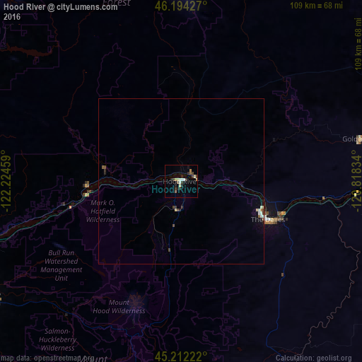
Analysis of Hood River night lights 2016
Square area 10x10 km:
 0.76%
0.76%90-99
1.67%80-89
2.12%70-79
1.06%60-69
0.45%50-59
1.52%40-49
1.06%30-39
3.03%20-29
3.64%10-19
1.06%0-9
83.64%Square area 50x50 km:
0.07%90-99
0.17%80-89
0.13%70-79
0.05%60-69
0.05%50-59
0.15%40-49
0.16%30-39
0.18%20-29
0.2%10-19
0.19%0-9
98.64%Clear (daylight) street map image can be seen on geolist.org.
Map coordinates:
46° 11' 39.4" North, 122° 13' 28.5" West
45° 42' 19.4" North, 121° 31' 17.3" West
45° 12' 44" North, 120° 49' 6" West
Some cities around Hood River sort by population:
• Gresham
74.4 km =46.2 mi,  251°
251°
• Camas
69.5 km =43.2 mi,  259°
259°
• Troutdale
69.8 km =43.4 mi, 254°
• The Dalles
29.4 km =18.3 mi,  114°
114°
• Washougal
66.1 km =41.1 mi, 258°
• Sandy
67 km =41.6 mi,  239°
239°
• Fairview
73.3 km =45.5 mi, 255°
• Mill Plain
75.9 km =47.2 mi, 264°
5731777 (p: 7,624)
Sources (retrieved 2019-11-25):
» Earth at Night: Flat Maps 2012, 2016