Sandy night lights from space
Night Light of Sandy (Oregon) from space (United States) Src. Average luminocity for 10x10km area is 10.9302% and for 50x50km: 13.139%.
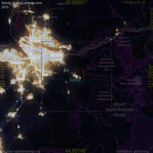
Analysis of Sandy night lights 2016
Square area 10x10 km:
 1.11%
1.11%90-99
1.43%80-89
1.9%70-79
0.63%60-69
3.02%50-59
1.43%40-49
1.11%30-39
0.79%20-29
0.79%10-19
1.43%0-9
86.35%Square area 50x50 km:
3.52%90-99
3.34%80-89
1.04%70-79
1.43%60-69
1.75%50-59
1.75%40-49
1.49%30-39
1.18%20-29
1.93%10-19
3.14%0-9
79.41%Clear (daylight) street map image can be seen on geolist.org.
Map coordinates:
45° 53' 20.1" North, 122° 57' 52.6" West
45° 23' 50.4" North, 122° 15' 41.3" West
44° 54' 5.3" North, 121° 33' 30.1" West
Some cities around Sandy sort by population:
• Gresham
17.4 km =10.8 mi,  310°
310°
• Camas
23.7 km =14.7 mi,  332°
332°
• Happy Valley
21.7 km =13.5 mi,  284°
284°
• Troutdale
18.6 km =11.6 mi, 328°
• Washougal
21.8 km =13.5 mi,  340°
340°
• Damascus
15.6 km =9.7 mi, 278°
• Fairview
20.7 km =12.9 mi,  319°
319°
• Clackamas
24.1 km =15 mi,  272°
272°
5750477 (p: 10,644)
Sources (retrieved 2019-11-25):
» Earth at Night: Flat Maps 2012, 2016