Macomb night lights from space
Night Light of Macomb (Illinois) from space (United States) Src. Average luminocity for 10x10km area is 27.7925% and for 50x50km: 1.8761%.
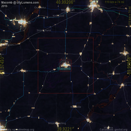
Analysis of Macomb night lights 2016
Square area 10x10 km:
 4.59%
4.59%90-99
4.25%80-89
3.23%70-79
3.91%60-69
4.42%50-59
2.21%40-49
3.23%30-39
0.85%20-29
4.93%10-19
30.61%0-9
37.76%Square area 50x50 km:
0.18%90-99
0.2%80-89
0.27%70-79
0.36%60-69
0.19%50-59
0.26%40-49
0.25%30-39
0.2%20-29
0.34%10-19
1.36%0-9
96.39%Clear (daylight) street map image can be seen on geolist.org.
Map coordinates:
40° 59' 31.4" North, 91° 22' 29.7" West
40° 27' 33.2" North, 90° 40' 18.5" West
39° 55' 19.6" North, 89° 58' 7.2" West
Some cities around Macomb sort by population:
• Quincy
85.5 km =53.1 mi,  227°
227°
• Galesburg
59.9 km =37.2 mi,  25°
25°
• Burlington
53.7 km =33.4 mi,  316°
316°
• Canton
54.9 km =34.1 mi,  78°
78°
• Fort Madison
57.6 km =35.8 mi,  289°
289°
• Keokuk
60.7 km =37.7 mi,  263°
263°
• Monmouth
50.3 km =31.3 mi,  2°
2°
• Beardstown
53.4 km =33.2 mi,  156°
156°
4900817 (p: 18,547)
Sources (retrieved 2019-11-25):
» Earth at Night: Flat Maps 2012, 2016