Canton night lights from space
Night Light of Canton (Illinois) from space (United States) Src. Average luminocity for 10x10km area is 18.6753% and for 50x50km: 2.1264%.
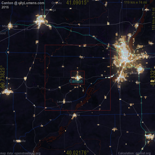
Analysis of Canton night lights 2016
Square area 10x10 km:
 1.62%
1.62%90-99
1.62%80-89
3.25%70-79
3.08%60-69
2.76%50-59
2.92%40-49
2.6%30-39
0.32%20-29
3.9%10-19
9.42%0-9
68.51%Square area 50x50 km:
0.07%90-99
0.09%80-89
0.53%70-79
0.27%60-69
0.25%50-59
0.4%40-49
0.33%30-39
0.51%20-29
0.5%10-19
0.48%0-9
96.59%Clear (daylight) street map image can be seen on geolist.org.
Map coordinates:
41° 5' 24.5" North, 90° 44' 17.7" West
40° 33' 29.1" North, 90° 2' 6.4" West
40° 1' 18.3" North, 89° 19' 55.2" West
Some cities around Canton sort by population:
• Peoria
40.6 km =25.2 mi,  68°
68°
• North Peoria
42 km =26.1 mi, 65°
• Pekin
33.3 km =20.7 mi,  88°
88°
• East Peoria
40.2 km =25 mi, 72°
• Morton
49 km =30.4 mi,  82°
82°
• Bartonville
33.9 km =21.1 mi, 72°
• Peoria Heights
44.2 km =27.5 mi,  61°
61°
• Creve Coeur
38.8 km =24.1 mi, 75°
4831990 (p: 14,211)
Sources (retrieved 2019-11-25):
» Earth at Night: Flat Maps 2012, 2016