Lincoln night lights from space
Night Light of Lincoln (California) from space (United States) Src. Average luminocity for 10x10km area is 38.6259% and for 50x50km: 21.2479%.
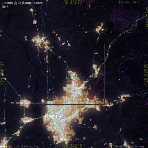
Analysis of Lincoln night lights 2016
Square area 10x10 km:
 3.4%
3.4%90-99
4.59%80-89
4.42%70-79
8.67%60-69
5.61%50-59
8.16%40-49
7.31%30-39
6.46%20-29
11.39%10-19
25.17%0-9
14.8%Square area 50x50 km:
3.4%90-99
3.93%80-89
2.03%70-79
4.25%60-69
3.99%50-59
3.03%40-49
2.58%30-39
2.92%20-29
3.72%10-19
7.65%0-9
62.49%Clear (daylight) street map image can be seen on geolist.org.
Map coordinates:
39° 26' 12.2" North, 121° 59' 46.1" West
38° 53' 29.6" North, 121° 17' 34.8" West
38° 20' 31.9" North, 120° 35' 23.6" West
Some cities around Lincoln sort by population:
• Roseville
15.5 km =9.6 mi,  178°
178°
• Citrus Heights
20.5 km =12.7 mi, 177°
• Rocklin
12.3 km =7.6 mi,  156°
156°
• Antelope
20.6 km =12.8 mi,  188°
188°
• Granite Bay
18.1 km =11.2 mi,  141°
141°
• Auburn
18.7 km =11.6 mi,  88°
88°
• North Auburn
18.8 km =11.7 mi,  76°
76°
• Loomis
11.7 km =7.3 mi,  132°
132°
5366375 (p: 46,474)
Sources (retrieved 2019-11-25):
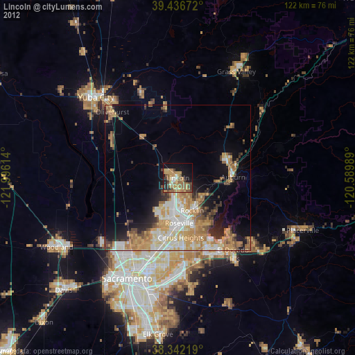
» Earth at Night: Flat Maps 2012, 2016