Folsom night lights from space
Night Light of Folsom (California) from space (United States) Src. Average luminocity for 10x10km area is 70.0323% and for 50x50km: 35.6415%.
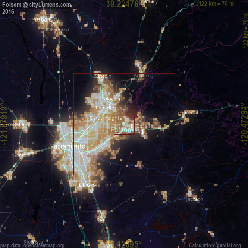
Analysis of Folsom night lights 2016
Square area 10x10 km:
 12.59%
90-99
14.8%80-89
7.65%70-79
9.01%60-69
25.34%50-59
15.99%40-49
4.76%30-39
4.93%20-29
4.93%10-19
0%0-9
0%Square area 50x50 km:
7.35%90-99
8.36%80-89
4.28%70-79
6.78%60-69
5.7%50-59
4.17%40-49
3.28%30-39
3.27%20-29
4.6%10-19
8.08%0-9
44.13%Clear (daylight) street map image can be seen on geolist.org.
Map coordinates:
39° 13' 29.1" North, 121° 52' 45.1" West
38° 40' 40.7" North, 121° 10' 33.8" West
38° 7' 37" North, 120° 28' 22.6" West
Some cities around Folsom sort by population:
• Roseville
12.7 km =7.9 mi,  310°
310°
• Citrus Heights
9.7 km =6 mi,  289°
289°
• Rocklin
13.6 km =8.5 mi,  337°
337°
• El Dorado Hills
8.2 km =5.1 mi,  83°
83°
• Orangevale
4.3 km =2.7 mi,  270°
270°
• Fair Oaks
9.1 km =5.7 mi,  246°
246°
• Granite Bay
9.5 km =5.9 mi,  6°
6°
• Gold River
8.4 km =5.2 mi,  226°
226°
5349705 (p: 76,375)
Sources (retrieved 2019-11-25):
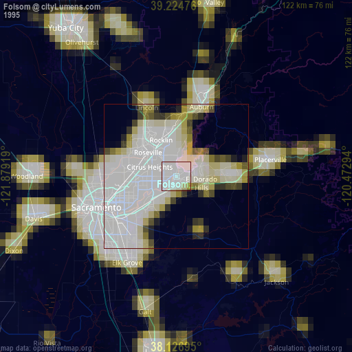
» NASA, Earths city lights 1995
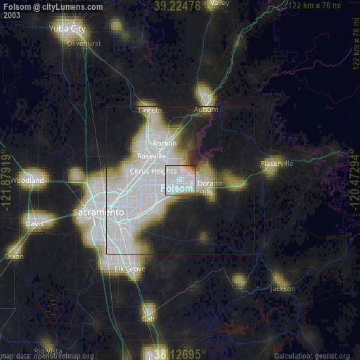
» NASA city lights 2003
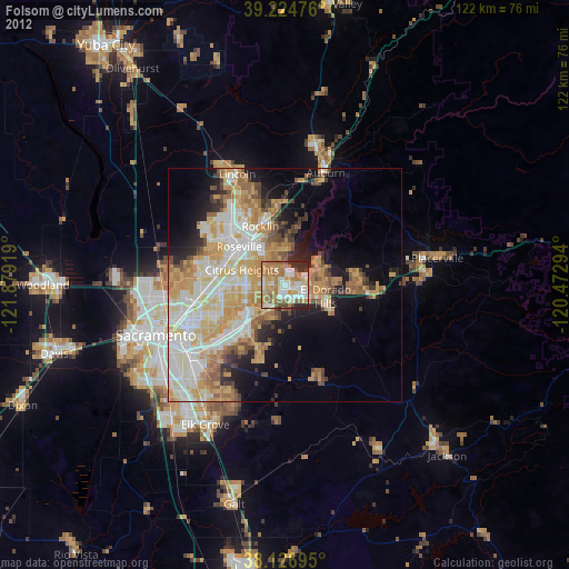
» Earth at Night: Flat Maps 2012, 2016