Longmont night lights from space
Night Light of Longmont (Colorado) from space (United States) Src. Average luminocity for 10x10km area is 62.1039% and for 50x50km: 21.7666%.
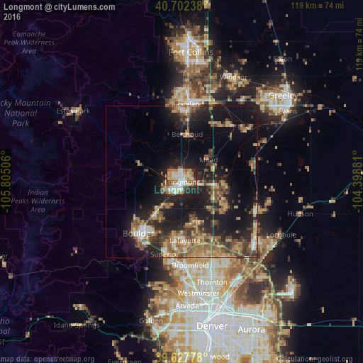
Analysis of Longmont night lights 2016
Square area 10x10 km:
 13.8%
13.8%90-99
13.64%80-89
8.77%70-79
9.74%60-69
12.66%50-59
3.41%40-49
6.49%30-39
4.22%20-29
19.97%10-19
7.31%0-9
0%Square area 50x50 km:
1.71%90-99
1.95%80-89
2.76%70-79
3.87%60-69
3.94%50-59
4.22%40-49
3.55%30-39
4.25%20-29
6.99%10-19
16.84%0-9
49.92%Clear (daylight) street map image can be seen on geolist.org.
Map coordinates:
40° 42' 8.6" North, 105° 48' 18.2" West
40° 10' 2" North, 105° 6' 6.9" West
39° 37' 40" North, 104° 23' 55.7" West
Some cities around Longmont sort by population:
• Boulder
22.2 km =13.8 mi,  220°
220°
• Lafayette
19.3 km =12 mi,  176°
176°
• Erie
13.7 km =8.5 mi,  161°
161°
• Louisville
21.2 km =13.2 mi,  186°
186°
• Firestone
15.3 km =9.5 mi,  113°
113°
• Frederick
15.9 km =9.9 mi,  118°
118°
• Gunbarrel
13 km =8.1 mi,  206°
206°
• Berthoud
15.8 km =9.8 mi,  6°
6°
5579276 (p: 92,088)
Sources (retrieved 2019-11-25):
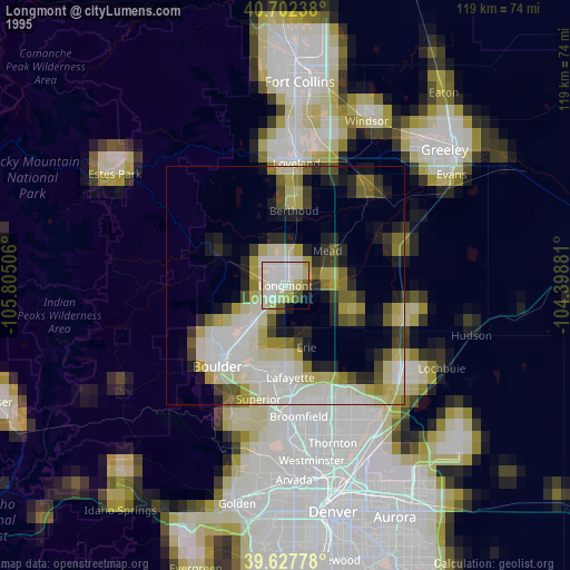
» NASA, Earths city lights 1995
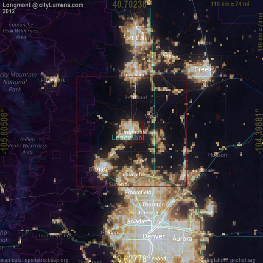
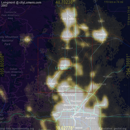
» NASA city lights 2003
» Earth at Night: Flat Maps 2012, 2016