Louisville night lights from space
Night Light of Louisville (Colorado) from space (United States) Src. Average luminocity for 10x10km area is 63.8401% and for 50x50km: 38.9727%.
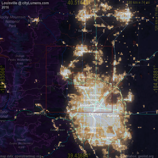
Analysis of Louisville night lights 2016
Square area 10x10 km:
 5.61%
5.61%90-99
8.67%80-89
9.69%70-79
15.48%60-69
19.9%50-59
16.33%40-49
8.84%30-39
6.8%20-29
8.67%10-19
0%0-9
0%Square area 50x50 km:
8.71%90-99
7.22%80-89
5.6%70-79
6.68%60-69
5.42%50-59
5.63%40-49
4.27%30-39
3.77%20-29
6.3%10-19
12.94%0-9
33.46%Clear (daylight) street map image can be seen on geolist.org.
Map coordinates:
40° 30' 51.9" North, 105° 50' 6.2" West
39° 58' 39.9" North, 105° 7' 54.9" West
39° 26' 12.6" North, 104° 25' 43.7" West
Some cities around Louisville sort by population:
• Boulder
12.5 km =7.8 mi,  289°
289°
• Broomfield
7.4 km =4.6 mi,  148°
148°
• Northglenn
16 km =9.9 mi,  129°
129°
• Lafayette
4 km =2.5 mi,  63°
63°
• Erie
10.7 km =6.6 mi,  40°
40°
• Superior
4.2 km =2.6 mi,  228°
228°
• Gunbarrel
10.1 km =6.3 mi,  340°
340°
• Shaw Heights
15.9 km =9.9 mi, 151°
5429522 (p: 20,396)
Sources (retrieved 2019-11-25):
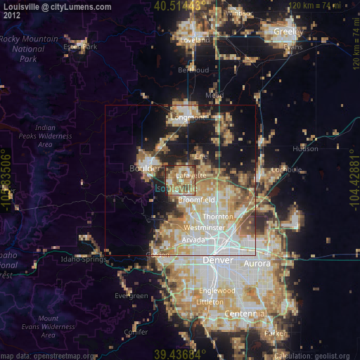
» Earth at Night: Flat Maps 2012, 2016