Boulder night lights from space
Night Light of Boulder (Colorado) from space (United States) Src. Average luminocity for 10x10km area is 49.0097% and for 50x50km: 24.3424%.
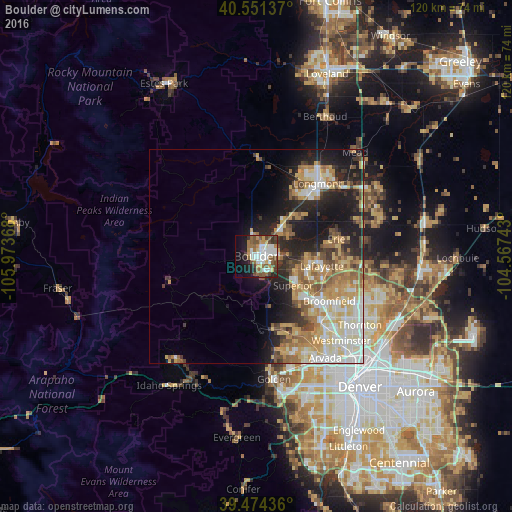
Analysis of Boulder night lights 2016
Square area 10x10 km:
 11.85%
90-99
10.55%80-89
2.92%70-79
5.84%60-69
5.84%50-59
11.2%40-49
8.93%30-39
3.08%20-29
8.44%10-19
17.37%0-9
13.96%Square area 50x50 km:
4.09%90-99
4.41%80-89
3.8%70-79
4.36%60-69
3.87%50-59
3.18%40-49
2.65%30-39
2.54%20-29
5.48%10-19
10.82%0-9
54.77%Clear (daylight) street map image can be seen on geolist.org.
Map coordinates:
40° 33' 4.9" North, 105° 58' 25.2" West
40° 0' 54" North, 105° 16' 14" West
39° 28' 27.7" North, 104° 34' 2.7" West
Some cities around Boulder sort by population:
• Longmont
22.2 km =13.8 mi,  40°
40°
• Broomfield
18.9 km =11.7 mi,  123°
123°
• Lafayette
15.6 km =9.7 mi,  98°
98°
• Erie
19.2 km =11.9 mi,  78°
78°
• Louisville
12.5 km =7.8 mi,  109°
109°
• Superior
11.1 km =6.9 mi,  128°
128°
• Gunbarrel
10 km =6.2 mi,  57°
57°
• Shaw Heights
26.5 km =16.5 mi, 132°
5574991 (p: 107,349)
Sources (retrieved 2019-11-25):
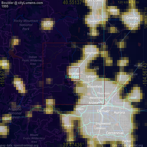
» NASA, Earths city lights 1995
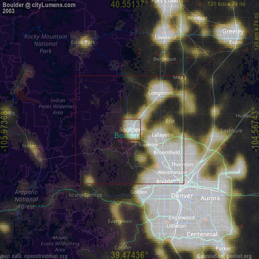
» NASA city lights 2003
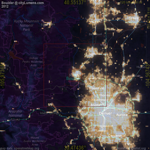
» Earth at Night: Flat Maps 2012, 2016