Litchfield night lights from space
Night Light of Litchfield (Illinois) from space (United States) Src. Average luminocity for 10x10km area is 18.1981% and for 50x50km: 4.2179%.
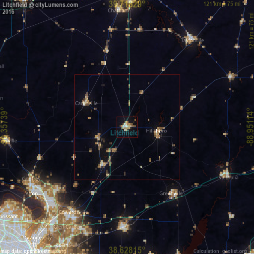
Analysis of Litchfield night lights 2016
Square area 10x10 km:
 1.46%
1.46%90-99
1.79%80-89
2.76%70-79
3.41%60-69
3.08%50-59
2.11%40-49
3.41%30-39
2.11%20-29
1.14%10-19
7.14%0-9
71.59%Square area 50x50 km:
0.15%90-99
0.35%80-89
0.5%70-79
0.54%60-69
0.93%50-59
0.8%40-49
0.75%30-39
0.67%20-29
0.65%10-19
1%0-9
93.67%Clear (daylight) street map image can be seen on geolist.org.
Map coordinates:
39° 43' 5.8" North, 90° 21' 26.6" West
39° 10' 31.2" North, 89° 39' 15.3" West
38° 37' 41.3" North, 88° 57' 4.1" West
Some cities around Litchfield sort by population:
• Edwardsville
48 km =29.8 mi,  212°
212°
• Highland
48.5 km =30.1 mi,  181°
181°
• Bethalto
44.6 km =27.7 mi,  228°
228°
• Greenville
37.7 km =23.4 mi,  146°
146°
• East Alton
51.3 km =31.9 mi, 230°
• Hillsboro
13.8 km =8.6 mi,  96°
96°
• Carlinville
22.8 km =14.2 mi,  300°
300°
• Staunton
21.6 km =13.4 mi, 213°
4243131 (p: 6,897)
Sources (retrieved 2019-11-25):
» Earth at Night: Flat Maps 2012, 2016