Highland night lights from space
Night Light of Highland (Illinois) from space (United States) Src. Average luminocity for 10x10km area is 29.8895% and for 50x50km: 14.2714%.
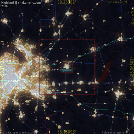
Analysis of Highland night lights 2016
Square area 10x10 km:
 2.72%
2.72%90-99
5.44%80-89
4.25%70-79
4.59%60-69
3.57%50-59
3.57%40-49
3.4%30-39
6.29%20-29
3.4%10-19
33.33%0-9
29.42%Square area 50x50 km:
1.19%90-99
2.04%80-89
2.44%70-79
1.9%60-69
1.97%50-59
2.13%40-49
2.4%30-39
3%20-29
2.93%10-19
6.41%0-9
73.59%Clear (daylight) street map image can be seen on geolist.org.
Map coordinates:
39° 17' 9" North, 90° 22' 27.6" West
38° 44' 22.2" North, 89° 40' 16.3" West
38° 11' 20.2" North, 88° 58' 5.1" West
Some cities around Highland sort by population:
• O'Fallon
26.5 km =16.5 mi,  231°
231°
• Edwardsville
25.7 km =16 mi,  288°
288°
• Collinsville
28.3 km =17.6 mi,  254°
254°
• Glen Carbon
27.1 km =16.8 mi,  272°
272°
• Shiloh
27.9 km =17.3 mi,  224°
224°
• Troy
18.4 km =11.4 mi, 266°
• Maryville
24.8 km =15.4 mi, 265°
• Greenville
28.1 km =17.5 mi,  52°
52°
4240679 (p: 9,848)
Sources (retrieved 2019-11-25):
» Earth at Night: Flat Maps 2012, 2016