Greenville night lights from space
Night Light of Greenville (Illinois) from space (United States) Src. Average luminocity for 10x10km area is 17.9762% and for 50x50km: 2.9527%.
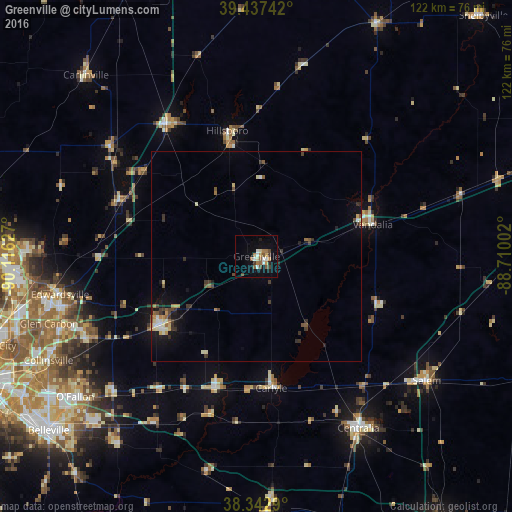
Analysis of Greenville night lights 2016
Square area 10x10 km:
 1.7%
1.7%90-99
3.06%80-89
1.7%70-79
2.38%60-69
2.72%50-59
4.08%40-49
2.72%30-39
1.36%20-29
1.36%10-19
8.5%0-9
70.41%Square area 50x50 km:
0.21%90-99
0.42%80-89
0.36%70-79
0.31%60-69
0.37%50-59
0.47%40-49
0.44%30-39
0.72%20-29
0.4%10-19
1.74%0-9
94.58%Clear (daylight) street map image can be seen on geolist.org.
Map coordinates:
39° 26' 14.7" North, 90° 6' 58.6" West
38° 53' 32.2" North, 89° 24' 47.3" West
38° 20' 34.4" North, 88° 42' 36.1" West
Some cities around Greenville sort by population:
• Edwardsville
47.6 km =29.6 mi,  259°
259°
• Centralia
47.5 km =29.5 mi,  149°
149°
• Troy
44.6 km =27.7 mi,  246°
246°
• Highland
28.1 km =17.5 mi,  232°
232°
• Vandalia
28.7 km =17.8 mi,  74°
74°
• Litchfield
37.7 km =23.4 mi,  326°
326°
• Hillsboro
30.7 km =19.1 mi,  346°
346°
• Staunton
35.3 km =21.9 mi,  292°
292°
4239867 (p: 6,666)
Sources (retrieved 2019-11-25):
» Earth at Night: Flat Maps 2012, 2016