Plainedge night lights from space
Night Light of Plainedge (New York) from space (United States) Src. Average luminocity for 10x10km area is 97.2094% and for 50x50km: 52.6063%.
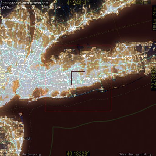
Analysis of Plainedge night lights 2016
Square area 10x10 km:
 51.46%
90-99
38.15%80-89
7.31%70-79
3.08%60-69
0%50-59
0%40-49
0%30-39
0%20-29
0%10-19
0%0-9
0%Square area 50x50 km:
18.97%90-99
12.32%80-89
5.79%70-79
6.69%60-69
5.76%50-59
4.83%40-49
3.05%30-39
3.05%20-29
6.17%10-19
8.4%0-9
24.98%Clear (daylight) street map image can be seen on geolist.org.
Map coordinates:
41° 14' 53.2" North, 74° 11' 12.7" West
40° 43' 2.4" North, 73° 29' 1.5" West
40° 10' 56.1" North, 72° 46' 50.2" West
Some cities around Plainedge sort by population:
• Levittown
2.7 km =1.7 mi,  290°
290°
• Massapequa
4.2 km =2.6 mi,  168°
168°
• Wantagh
4.3 km =2.7 mi,  210°
210°
• North Massapequa
2.6 km =1.6 mi,  134°
134°
• Bethpage
3 km =1.9 mi,  2°
2°
• South Farmingdale
3.7 km =2.3 mi,  84°
84°
• North Wantagh
3.3 km =2.1 mi,  217°
217°
• Farmingdale
3.7 km =2.3 mi,  62°
62°
5131628 (p: 8,817)
Sources (retrieved 2019-11-25):
» Earth at Night: Flat Maps 2012, 2016