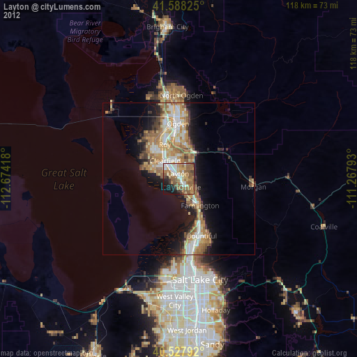
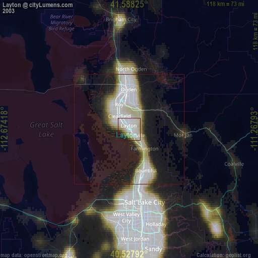
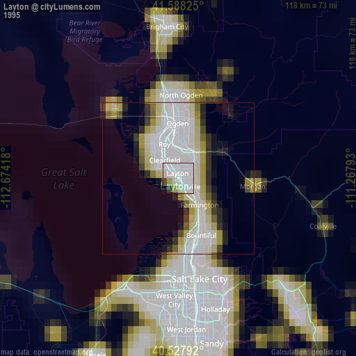
Layton night lights from space
Night Light of Layton (Utah) from space (United States) Src. Average luminocity for 10x10km area is 63.4513% and for 50x50km: 16.3167%.
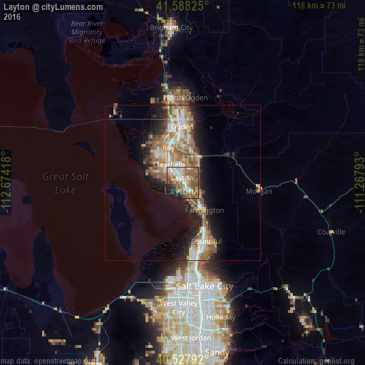
Analysis of Layton night lights 2016
Square area 10x10 km:
 10.88%
90-99
13.31%80-89
4.38%70-79
8.77%60-69
17.05%50-59
22.73%40-49
6.49%30-39
2.27%20-29
7.31%10-19
6.17%0-9
0.65%Square area 50x50 km:
2.4%90-99
2.62%80-89
1.58%70-79
2.75%60-69
3.49%50-59
3.69%40-49
1.88%30-39
1.59%20-29
3.86%10-19
6.94%0-9
69.2%Clear (daylight) street map image can be seen on geolist.org.
Map coordinates:
41° 35' 17.7" North, 112° 40' 27" West
41° 3' 36.8" North, 111° 58' 15.8" West
40° 31' 40.5" North, 111° 16' 4.5" West
Some cities around Layton sort by population:
• Clearfield
7.3 km =4.5 mi,  320°
320°
• Kaysville
3.9 km =2.4 mi,  135°
135°
• Syracuse
8.5 km =5.3 mi,  292°
292°
• Farmington
11.3 km =7 mi, 141°
• Clinton
11.1 km =6.9 mi, 322°
• South Weber
8.7 km =5.4 mi,  23°
23°
• Fruit Heights
6.6 km =4.1 mi,  118°
118°
• Sunset
9.8 km =6.1 mi,  329°
329°
5777107 (p: 74,143)
Sources (retrieved 2019-11-25):
» NASA, Earths city lights 1995
» NASA city lights 2003
» Earth at Night: Flat Maps 2012, 2016