South Weber night lights from space
Night Light of South Weber (Utah) from space (United States) Src. Average luminocity for 10x10km area is 51.474% and for 50x50km: 15.5433%.
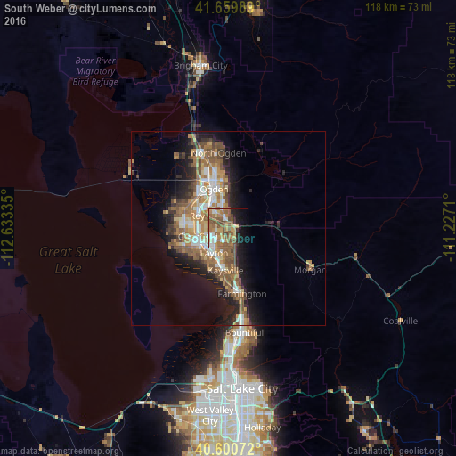
Analysis of South Weber night lights 2016
Square area 10x10 km:
 6.17%
6.17%90-99
6.01%80-89
5.84%70-79
9.58%60-69
12.82%50-59
20.45%40-49
6.66%30-39
3.08%20-29
5.03%10-19
15.58%0-9
8.77%Square area 50x50 km:
2.09%90-99
2.26%80-89
1.34%70-79
2.58%60-69
3.39%50-59
3.88%40-49
2.25%30-39
1.72%20-29
3.57%10-19
7.13%0-9
69.8%Clear (daylight) street map image can be seen on geolist.org.
Map coordinates:
41° 39' 35.6" North, 112° 38' 0.1" West
41° 7' 56.8" North, 111° 55' 48.8" West
40° 36' 2.6" North, 111° 13' 37.6" West
Some cities around South Weber sort by population:
• Ogden
10.7 km =6.6 mi,  340°
340°
• Layton
8.7 km =5.4 mi,  203°
203°
• Roy
8.7 km =5.4 mi,  291°
291°
• Clearfield
8.4 km =5.2 mi,  253°
253°
• Clinton
10.1 km =6.3 mi,  274°
274°
• Washington Terrace
5.9 km =3.7 mi,  319°
319°
• Riverdale
7.9 km =4.9 mi,  308°
308°
• Sunset
8.5 km =5.3 mi, 272°
5781809 (p: 6,971)
Sources (retrieved 2019-11-25):
» Earth at Night: Flat Maps 2012, 2016