Laurel night lights from space
Night Light of Laurel (Maryland) from space (United States) Src. Average luminocity for 10x10km area is 83.7922% and for 50x50km: 71.7849%.
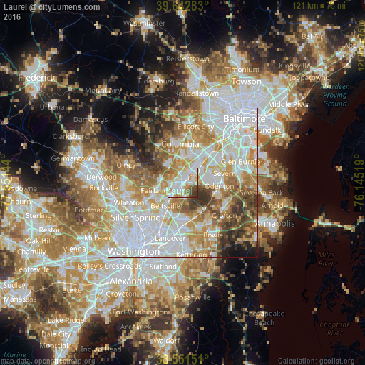
Analysis of Laurel night lights 2016
Square area 10x10 km:
 25.97%
90-99
28.57%80-89
11.69%70-79
12.18%60-69
7.63%50-59
5.36%40-49
4.71%30-39
3.73%20-29
0.16%10-19
0%0-9
0%Square area 50x50 km:
23.39%90-99
17.21%80-89
8.96%70-79
10.81%60-69
9.35%50-59
7.73%40-49
5.21%30-39
5.41%20-29
3.88%10-19
4.21%0-9
3.85%Clear (daylight) street map image can be seen on geolist.org.
Map coordinates:
39° 38' 34.2" North, 77° 33' 5.2" West
39° 5' 57.4" North, 76° 50' 53.9" West
38° 33' 5.4" North, 76° 8' 42.7" West
Some cities around Laurel sort by population:
• South Laurel
3.3 km =2.1 mi,  182°
182°
• Scaggsville
6.8 km =4.2 mi,  318°
318°
• Beltsville
8.8 km =5.5 mi,  215°
215°
• Maryland City
2.8 km =1.7 mi,  106°
106°
• Fort George G Mead Junction
5.9 km =3.7 mi,  59°
59°
• Burtonsville
7.4 km =4.6 mi,  280°
280°
• Jessup
8.4 km =5.2 mi,  48°
48°
• Savage
4.8 km =3 mi,  26°
26°
4360369 (p: 26,215)
Sources (retrieved 2019-11-25):
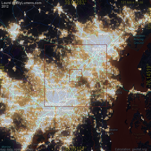
» Earth at Night: Flat Maps 2012, 2016