South Laurel night lights from space
Night Light of South Laurel (Maryland) from space (United States) Src. Average luminocity for 10x10km area is 76.8003% and for 50x50km: 72.3543%.
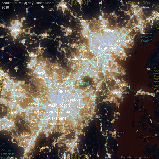
Analysis of South Laurel night lights 2016
Square area 10x10 km:
 20.29%
90-99
22.56%80-89
6.66%70-79
13.15%60-69
12.99%50-59
8.28%40-49
8.6%30-39
7.31%20-29
0.16%10-19
0%0-9
0%Square area 50x50 km:
23.53%90-99
17.6%80-89
9.26%70-79
11.03%60-69
9.31%50-59
7.48%40-49
5.1%30-39
5.13%20-29
3.75%10-19
3.91%0-9
3.92%Clear (daylight) street map image can be seen on geolist.org.
Map coordinates:
39° 36' 49" North, 77° 33' 12.2" West
39° 4' 11.4" North, 76° 51' 0.9" West
38° 31' 18.6" North, 76° 8' 49.7" West
Some cities around South Laurel sort by population:
• Laurel
3.3 km =2.1 mi,  2°
2°
• Greenbelt
7.6 km =4.7 mi,  196°
196°
• Calverton
7.5 km =4.7 mi,  259°
259°
• Beltsville
6.3 km =3.9 mi,  231°
231°
• Maryland City
3.7 km =2.3 mi,  48°
48°
• Fort George G Mead Junction
8.2 km =5.1 mi,  40°
40°
• Burtonsville
8.5 km =5.3 mi,  302°
302°
• Savage
7.9 km =4.9 mi,  16°
16°
4369978 (p: 26,112)
Sources (retrieved 2019-11-25):
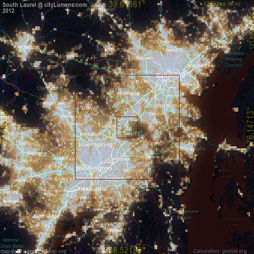
» Earth at Night: Flat Maps 2012, 2016