Latham night lights from space
Night Light of Latham (New York) from space (United States) Src. Average luminocity for 10x10km area is 73.8015% and for 50x50km: 23.3476%.
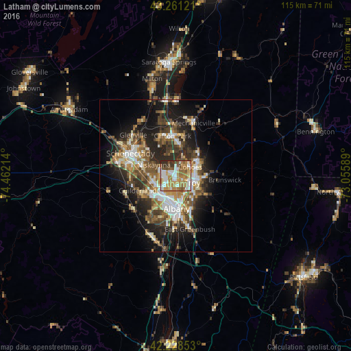
Analysis of Latham night lights 2016
Square area 10x10 km:
 16.21%
90-99
17.27%80-89
6.67%70-79
18.79%60-69
17.42%50-59
9.39%40-49
4.85%30-39
5.91%20-29
3.48%10-19
0%0-9
0%Square area 50x50 km:
3.61%90-99
4.03%80-89
2.62%70-79
2.97%60-69
3.17%50-59
3.89%40-49
4.41%30-39
4%20-29
6.81%10-19
10.9%0-9
53.6%Clear (daylight) street map image can be seen on geolist.org.
Map coordinates:
43° 15' 40.4" North, 74° 27' 43.7" West
42° 44' 49.3" North, 73° 45' 32.4" West
42° 13' 42.7" North, 73° 3' 21.2" West
Some cities around Latham sort by population:
• Albany
10.5 km =6.5 mi,  178°
178°
• West Albany
7.3 km =4.5 mi,  192°
192°
• Troy
5.9 km =3.7 mi,  110°
110°
• Cohoes
5.7 km =3.5 mi,  57°
57°
• Roessleville
7 km =4.3 mi,  214°
214°
• Watervliet
5.1 km =3.2 mi, 111°
• Colonie
6.9 km =4.3 mi,  241°
241°
• Westmere
10.9 km =6.8 mi, 235°
5124045 (p: 20,736)
Sources (retrieved 2019-11-25):
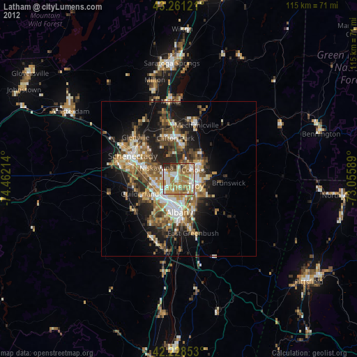
» Earth at Night: Flat Maps 2012, 2016