Westmere night lights from space
Night Light of Westmere (New York) from space (United States) Src. Average luminocity for 10x10km area is 58.2576% and for 50x50km: 22.8018%.
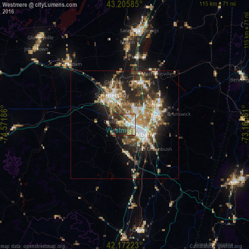
Analysis of Westmere night lights 2016
Square area 10x10 km:
 11.67%
90-99
11.52%80-89
9.7%70-79
6.82%60-69
8.48%50-59
9.09%40-49
6.82%30-39
10.61%20-29
14.7%10-19
10.15%0-9
0.45%Square area 50x50 km:
3.53%90-99
3.97%80-89
2.73%70-79
2.93%60-69
3.13%50-59
3.89%40-49
4.16%30-39
3.92%20-29
6.52%10-19
9.27%0-9
55.95%Clear (daylight) street map image can be seen on geolist.org.
Map coordinates:
43° 12' 21.1" North, 74° 34' 18.7" West
42° 41' 28.3" North, 73° 52' 7.4" West
42° 10' 20" North, 73° 9' 56.2" West
Some cities around Westmere sort by population:
• Albany
10.1 km =6.3 mi,  115°
115°
• West Albany
7.4 km =4.6 mi,  96°
96°
• Latham
10.9 km =6.8 mi,  55°
55°
• Rotterdam
13.5 km =8.4 mi,  321°
321°
• Roessleville
5.1 km =3.2 mi,  85°
85°
• Rensselaer
11.6 km =7.2 mi, 117°
• Delmar
8.2 km =5.1 mi,  158°
158°
• Colonie
4.1 km =2.5 mi,  44°
44°
5144097 (p: 7,284)
Sources (retrieved 2019-11-25):
» Earth at Night: Flat Maps 2012, 2016