West Albany night lights from space
Night Light of West Albany (New York) from space (United States) Src. Average luminocity for 10x10km area is 83.5667% and for 50x50km: 22.4765%.
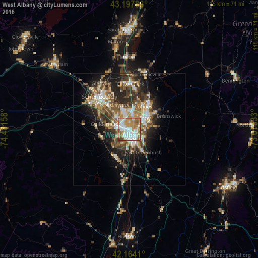

Analysis of West Albany night lights 2016
Square area 10x10 km:
 27.42%
90-99
23.03%80-89
6.97%70-79
20.3%60-69
11.97%50-59
6.21%40-49
2.58%30-39
1.52%20-29
0%10-19
0%0-9
0%Square area 50x50 km:
3.51%90-99
3.93%80-89
2.69%70-79
2.89%60-69
3.08%50-59
3.84%40-49
4.06%30-39
3.87%20-29
6.44%10-19
9.06%0-9
56.63%Clear (daylight) street map image can be seen on geolist.org.
Map coordinates:
43° 11' 52.3" North, 74° 28' 53.7" West
42° 40' 59.3" North, 73° 46' 42.4" West
42° 9' 50.8" North, 73° 4' 31.2" West
Some cities around West Albany sort by population:
• Albany
3.9 km =2.4 mi,  151°
151°
• Latham
7.3 km =4.5 mi,  12°
12°
• Roessleville
2.7 km =1.7 mi,  299°
299°
• Watervliet
8.2 km =5.1 mi,  50°
50°
• Rensselaer
5.4 km =3.4 mi, 147°
• Delmar
8.1 km =5 mi,  213°
213°
• Colonie
5.9 km =3.7 mi,  310°
310°
• Westmere
7.4 km =4.6 mi,  276°
276°
5143620 (p: 93,794)
Sources (retrieved 2019-11-25):
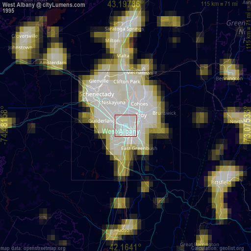
» NASA, Earths city lights 1995
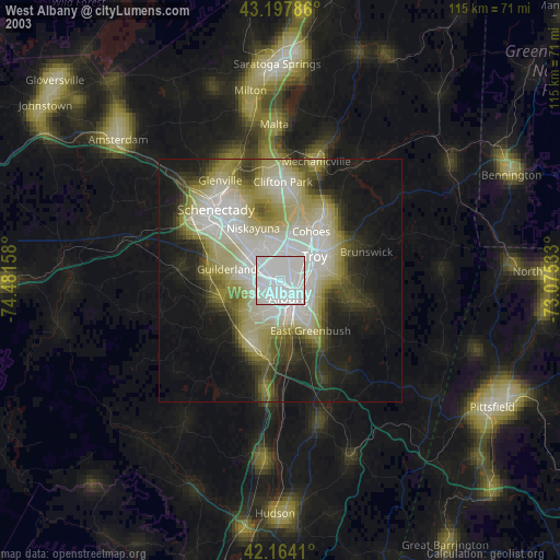
» NASA city lights 2003
» Earth at Night: Flat Maps 2012, 2016