Cohoes night lights from space
Night Light of Cohoes (New York) from space (United States) Src. Average luminocity for 10x10km area is 64.7515% and for 50x50km: 23.1263%.
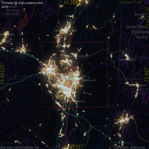
Analysis of Cohoes night lights 2016
Square area 10x10 km:
 12.27%
90-99
14.24%80-89
7.88%70-79
11.97%60-69
11.67%50-59
8.64%40-49
9.7%30-39
8.94%20-29
12.42%10-19
2.27%0-9
0%Square area 50x50 km:
3.62%90-99
4.07%80-89
2.65%70-79
2.95%60-69
3.08%50-59
3.81%40-49
4.38%30-39
4.04%20-29
6.62%10-19
10.68%0-9
54.1%Clear (daylight) street map image can be seen on geolist.org.
Map coordinates:
43° 17' 17.6" North, 74° 24' 11.7" West
42° 46' 27.3" North, 73° 42' 0.4" West
42° 15' 21.5" North, 72° 59' 49.2" West
Some cities around Cohoes sort by population:
• Albany
14.3 km =8.9 mi,  198°
198°
• West Albany
12 km =7.5 mi,  212°
212°
• Troy
5.1 km =3.2 mi,  172°
172°
• Latham
5.7 km =3.5 mi,  237°
237°
• Roessleville
12.4 km =7.7 mi,  224°
224°
• Watervliet
4.9 km =3 mi,  181°
181°
• Colonie
12.6 km =7.8 mi, 240°
• Mechanicville
14.3 km =8.9 mi,  4°
4°
5113142 (p: 16,538)
Sources (retrieved 2019-11-25):
» Earth at Night: Flat Maps 2012, 2016