Largo night lights from space
Night Light of Largo (Maryland) from space (United States) Src. Average luminocity for 10x10km area is 88.4541% and for 50x50km: 63.9852%.
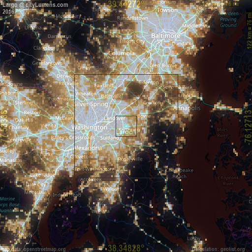
Analysis of Largo night lights 2016
Square area 10x10 km:
 35.03%
90-99
19.9%80-89
17.18%70-79
18.88%60-69
8.5%50-59
0.51%40-49
0%30-39
0%20-29
0%10-19
0%0-9
0%Square area 50x50 km:
19.12%90-99
13.84%80-89
9.2%70-79
9.85%60-69
9.05%50-59
7.59%40-49
5.26%30-39
5.6%20-29
4.08%10-19
4.22%0-9
12.2%Clear (daylight) street map image can be seen on geolist.org.
Map coordinates:
39° 26' 33.8" North, 77° 32' 0.2" West
38° 53' 51.4" North, 76° 49' 48.9" West
38° 20' 53.8" North, 76° 7' 37.7" West
Some cities around Largo sort by population:
• Kettering
2 km =1.2 mi,  137°
137°
• Forestville
7 km =4.3 mi,  213°
213°
• Walker Mill
5.6 km =3.5 mi,  243°
243°
• Summerfield
3.4 km =2.1 mi,  283°
283°
• Lake Arbor
1.1 km =0.7 mi,  2°
2°
• Westphalia
6 km =3.7 mi,  164°
164°
• Glenarden
4.4 km =2.7 mi,  322°
322°
• District Heights
6.8 km =4.2 mi,  229°
229°
4360345 (p: 10,709)
Sources (retrieved 2019-11-25):
» Earth at Night: Flat Maps 2012, 2016