Lake Arbor night lights from space
Night Light of Lake Arbor (Maryland) from space (United States) Src. Average luminocity for 10x10km area is 89.8469% and for 50x50km: 65.4522%.
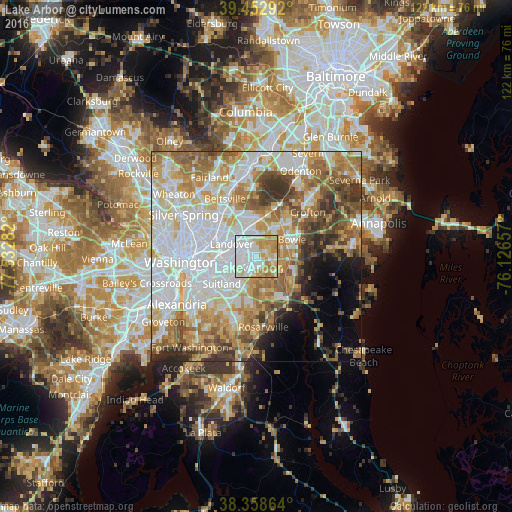
Analysis of Lake Arbor night lights 2016
Square area 10x10 km:
 36.73%
90-99
22.62%80-89
16.5%70-79
17.35%60-69
6.8%50-59
0%40-49
0%30-39
0%20-29
0%10-19
0%0-9
0%Square area 50x50 km:
19.56%90-99
14.37%80-89
9.38%70-79
10.07%60-69
9.31%50-59
8.09%40-49
5.35%30-39
5.33%20-29
3.68%10-19
3.84%0-9
11.04%Clear (daylight) street map image can be seen on geolist.org.
Map coordinates:
39° 27' 10.5" North, 77° 31' 58.2" West
38° 54' 28.4" North, 76° 49' 46.9" West
38° 21' 31.1" North, 76° 7' 35.7" West
Some cities around Lake Arbor sort by population:
• Landover
6.5 km =4 mi,  296°
296°
• Seabrook
6.8 km =4.2 mi,  347°
347°
• Kettering
2.9 km =1.8 mi,  153°
153°
• Walker Mill
6.2 km =3.9 mi,  234°
234°
• Summerfield
3.4 km =2.1 mi,  263°
263°
• Largo
1.1 km =0.7 mi,  182°
182°
• Glenarden
3.6 km =2.2 mi,  310°
310°
• Fairwood
7 km =4.3 mi,  39°
39°
4360138 (p: 9,776)
Sources (retrieved 2019-11-25):
» Earth at Night: Flat Maps 2012, 2016