Summerfield night lights from space
Night Light of Summerfield (Maryland) from space (United States) Src. Average luminocity for 10x10km area is 95.9949% and for 50x50km: 68.0905%.
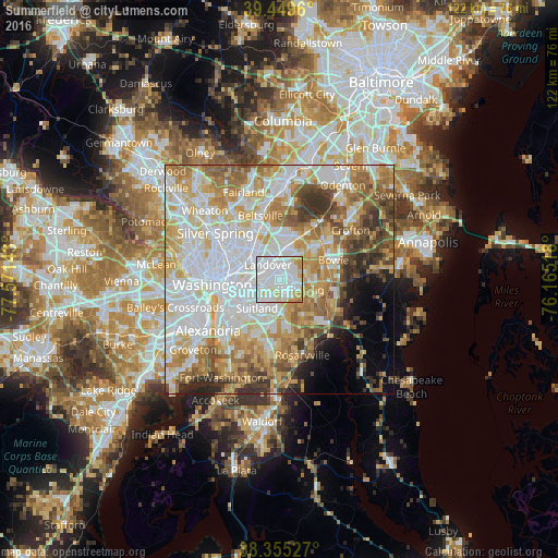
Analysis of Summerfield night lights 2016
Square area 10x10 km:
 59.35%
90-99
23.3%80-89
10.03%70-79
6.8%60-69
0.51%50-59
0%40-49
0%30-39
0%20-29
0%10-19
0%0-9
0%Square area 50x50 km:
21.07%90-99
15.68%80-89
10.12%70-79
10.54%60-69
8.93%50-59
7.46%40-49
4.9%30-39
4.81%20-29
3.8%10-19
3.19%0-9
9.49%Clear (daylight) street map image can be seen on geolist.org.
Map coordinates:
39° 26' 58.6" North, 77° 34' 17.1" West
38° 54' 16.3" North, 76° 52' 5.9" West
38° 21' 19" North, 76° 9' 54.6" West
Some cities around Summerfield sort by population:
• Landover
4.1 km =2.5 mi,  323°
323°
• Kettering
5.1 km =3.2 mi,  115°
115°
• Walker Mill
3.7 km =2.3 mi,  208°
208°
• Largo
3.4 km =2.1 mi,  103°
103°
• Lake Arbor
3.4 km =2.1 mi,  83°
83°
• Cheverly
4.9 km =3 mi,  302°
302°
• Woodlawn
5.4 km =3.4 mi,  338°
338°
• Glenarden
2.8 km =1.7 mi,  11°
11°
7315263 (p: 10,898)
Sources (retrieved 2019-11-25):
» Earth at Night: Flat Maps 2012, 2016