Westphalia night lights from space
Night Light of Westphalia (Maryland) from space (United States) Src. Average luminocity for 10x10km area is 75.5442% and for 50x50km: 57.0225%.
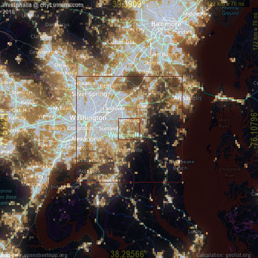
Analysis of Westphalia night lights 2016
Square area 10x10 km:
 10.88%
90-99
11.22%80-89
18.54%70-79
21.26%60-69
22.45%50-59
13.44%40-49
1.87%30-39
0.34%20-29
0%10-19
0%0-9
0%Square area 50x50 km:
16.86%90-99
11.14%80-89
8.34%70-79
8.32%60-69
7.29%50-59
7.14%40-49
5.88%30-39
6.84%20-29
4.58%10-19
5.38%0-9
18.22%Clear (daylight) street map image can be seen on geolist.org.
Map coordinates:
39° 23' 27.2" North, 77° 30' 51.2" West
38° 50' 43.4" North, 76° 48' 39.9" West
38° 17' 44.4" North, 76° 6' 28.7" West
Some cities around Westphalia sort by population:
• Greater Upper Marlboro
5.7 km =3.5 mi,  105°
105°
• Kettering
4.4 km =2.7 mi,  355°
355°
• Forestville
5.5 km =3.4 mi,  269°
269°
• Largo
6 km =3.7 mi,  344°
344°
• Lake Arbor
7.1 km =4.4 mi,  346°
346°
• Brock Hall
4.4 km =2.7 mi,  83°
83°
• Marlboro Village
3.9 km =2.4 mi, 114°
• District Heights
6.9 km =4.3 mi,  281°
281°
4373275 (p: 7,266)
Sources (retrieved 2019-11-25):
» Earth at Night: Flat Maps 2012, 2016