Kettering night lights from space
Night Light of Kettering (Maryland) from space (United States) Src. Average luminocity for 10x10km area is 82.915% and for 50x50km: 61.2804%.
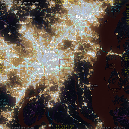
Analysis of Kettering night lights 2016
Square area 10x10 km:
 23.3%
23.3%90-99
15.65%80-89
18.71%70-79
21.94%60-69
16.33%50-59
4.08%40-49
0%30-39
0%20-29
0%10-19
0%0-9
0%Square area 50x50 km:
17.97%90-99
12.66%80-89
8.8%70-79
9.18%60-69
8.62%50-59
7.67%40-49
5.66%30-39
6.46%20-29
4.19%10-19
4.82%0-9
13.97%Clear (daylight) street map image can be seen on geolist.org.
Map coordinates:
39° 25' 47.2" North, 77° 31' 4.2" West
38° 53' 4.4" North, 76° 48' 52.9" West
38° 20' 6.5" North, 76° 6' 41.7" West
Some cities around Kettering sort by population:
• Forestville
6.8 km =4.2 mi,  229°
229°
• Walker Mill
6.5 km =4 mi,  260°
260°
• Summerfield
5.1 km =3.2 mi,  295°
295°
• Largo
2 km =1.2 mi,  317°
317°
• Lake Arbor
2.9 km =1.8 mi,  333°
333°
• Brock Hall
6 km =3.7 mi,  129°
129°
• Westphalia
4.4 km =2.7 mi,  175°
175°
• Glenarden
6.4 km =4 mi, 320°
4359858 (p: 12,790)
Sources (retrieved 2019-11-25):
» Earth at Night: Flat Maps 2012, 2016