Klahanie night lights from space
Night Light of Klahanie (Washington) from space (United States) Src. Average luminocity for 10x10km area is 41.8949% and for 50x50km: 33.7416%.
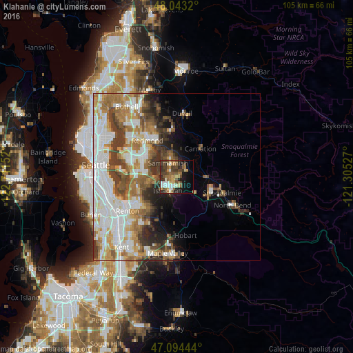
Analysis of Klahanie night lights 2016
Square area 10x10 km:
 4.55%
4.55%90-99
5.54%80-89
6.39%70-79
5.26%60-69
8.24%50-59
7.95%40-49
12.36%30-39
5.97%20-29
10.51%10-19
14.2%0-9
19.03%Square area 50x50 km:
9.1%90-99
7.64%80-89
2.99%70-79
4.09%60-69
5.77%50-59
4.24%40-49
4.35%30-39
4.56%20-29
3.62%10-19
4.45%0-9
49.2%Clear (daylight) street map image can be seen on geolist.org.
Map coordinates:
48° 2' 35.5" North, 122° 42' 41.5" West
47° 34' 15.5" North, 122° 0' 30.2" West
47° 5' 40" North, 121° 18' 19" West
Some cities around Klahanie sort by population:
• Redmond
14.3 km =8.9 mi,  323°
323°
• Sammamish
9.5 km =5.9 mi,  325°
325°
• City of Sammamish
4.3 km =2.7 mi, 329°
• Issaquah
4.9 km =3 mi,  201°
201°
• West Lake Sammamish
7 km =4.3 mi,  276°
276°
• Union Hill-Novelty Hill
12.1 km =7.5 mi,  352°
352°
• Newcastle
11.6 km =7.2 mi,  252°
252°
• East Renton Highlands
12.4 km =7.7 mi,  219°
219°
7315415 (p: 10,674)
Sources (retrieved 2019-11-25):
» Earth at Night: Flat Maps 2012, 2016