Sammamish night lights from space
Night Light of Sammamish (Washington) from space (United States) Src. Average luminocity for 10x10km area is 54.8452% and for 50x50km: 39.3941%.
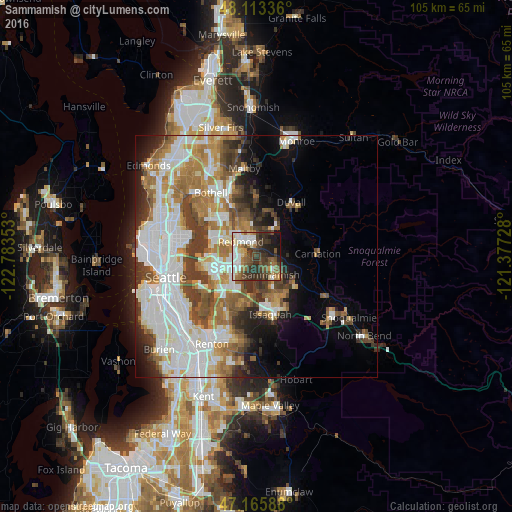
Analysis of Sammamish night lights 2016
Square area 10x10 km:
 11.31%
90-99
9.52%80-89
6.25%70-79
2.83%60-69
8.93%50-59
10.42%40-49
10.86%30-39
17.56%20-29
13.1%10-19
8.93%0-9
0.3%Square area 50x50 km:
11.31%90-99
9.16%80-89
3.15%70-79
4.45%60-69
6.59%50-59
4.44%40-49
4.91%30-39
5.06%20-29
4.47%10-19
5.79%0-9
40.65%Clear (daylight) street map image can be seen on geolist.org.
Map coordinates:
48° 6' 48.1" North, 122° 47' 0.7" West
47° 38' 30.4" North, 122° 4' 49.4" West
47° 9' 57.2" North, 121° 22' 38.2" West
Some cities around Sammamish sort by population:
• Bellevue
9.7 km =6 mi,  248°
248°
• Kirkland
10.6 km =6.6 mi,  294°
294°
• Redmond
4.7 km =2.9 mi,  319°
319°
• City of Sammamish
5.2 km =3.2 mi,  142°
142°
• West Lake Sammamish
7.3 km =4.5 mi,  192°
192°
• Cottage Lake
11.4 km =7.1 mi,  1°
1°
• Union Hill-Novelty Hill
5.7 km =3.5 mi,  43°
43°
• Klahanie
9.5 km =5.9 mi,  145°
145°
5809402 (p: 52,253)
Sources (retrieved 2019-11-25):
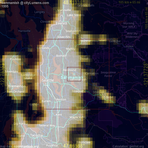
» NASA, Earths city lights 1995
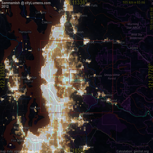
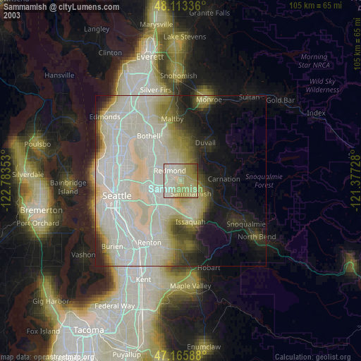
» NASA city lights 2003
» Earth at Night: Flat Maps 2012, 2016