East Renton Highlands night lights from space
Night Light of East Renton Highlands (Washington) from space (United States) Src. Average luminocity for 10x10km area is 41.2216% and for 50x50km: 40.2522%.
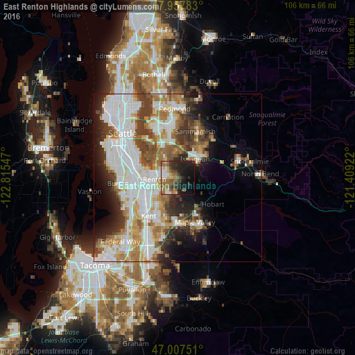
Analysis of East Renton Highlands night lights 2016
Square area 10x10 km:
 4.55%
4.55%90-99
4.83%80-89
4.97%70-79
2.98%60-69
12.93%50-59
9.66%40-49
4.97%30-39
8.52%20-29
12.64%10-19
22.3%0-9
11.65%Square area 50x50 km:
11.7%90-99
9.51%80-89
3.6%70-79
4.68%60-69
5.54%50-59
4.31%40-49
4.32%30-39
5.14%20-29
5.67%10-19
7.74%0-9
37.78%Clear (daylight) street map image can be seen on geolist.org.
Map coordinates:
47° 57' 28.2" North, 122° 48' 55.7" West
47° 29' 5.4" North, 122° 6' 44.4" West
47° 0' 27" North, 121° 24' 33.2" West
Some cities around East Renton Highlands sort by population:
• Renton
7.9 km =4.9 mi,  268°
268°
• Issaquah
7.8 km =4.8 mi,  49°
49°
• West Lake Sammamish
10.3 km =6.4 mi,  4°
4°
• Maple Valley
11.4 km =7.1 mi,  154°
154°
• Tukwila
11.2 km =7 mi,  263°
263°
• Fairwood
5.3 km =3.3 mi,  219°
219°
• Bryn Mawr-Skyway
9.7 km =6 mi,  276°
276°
• Newcastle
6.8 km =4.2 mi,  331°
331°
5793242 (p: 11,140)
Sources (retrieved 2019-11-25):
» Earth at Night: Flat Maps 2012, 2016