King City night lights from space
Night Light of King City (California) from space (United States) Src. Average luminocity for 10x10km area is 10.6801% and for 50x50km: 1.1734%.
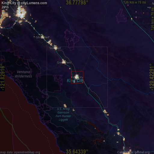
Analysis of King City night lights 2016
Square area 10x10 km:
 1.05%
1.05%90-99
1.05%80-89
1.4%70-79
0.7%60-69
2.8%50-59
1.4%40-49
1.92%30-39
2.27%20-29
1.4%10-19
1.05%0-9
84.97%Square area 50x50 km:
0.08%90-99
0.15%80-89
0.13%70-79
0.14%60-69
0.2%50-59
0.24%40-49
0.3%30-39
0.17%20-29
0.06%10-19
0.12%0-9
98.41%Clear (daylight) street map image can be seen on geolist.org.
Map coordinates:
36° 46' 40.7" North, 121° 49' 45" West
36° 12' 45.9" North, 121° 7' 33.7" West
35° 38' 36.2" North, 120° 25' 22.5" West
Some cities around King City sort by population:
• Salinas
70.1 km =43.6 mi,  317°
317°
• Hollister
75.3 km =46.8 mi,  340°
340°
• Paso Robles
76 km =47.2 mi,  148°
148°
• Soledad
29.6 km =18.4 mi, 322°
• Greenfield
16 km =9.9 mi, 318°
• Coalinga
69.2 km =43 mi,  96°
96°
• Gonzales
43.4 km =27 mi, 318°
• Cambria
72.2 km =44.9 mi,  176°
176°
5363208 (p: 13,902)
Sources (retrieved 2019-11-25):
» Earth at Night: Flat Maps 2012, 2016