Gonzales night lights from space
Night Light of Gonzales (California) from space (United States) Src. Average luminocity for 10x10km area is 8.3516% and for 50x50km: 4.7491%.
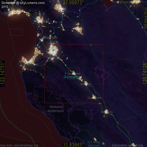
Analysis of Gonzales night lights 2016
Square area 10x10 km:
 0%
0%90-99
1.47%80-89
0%70-79
0%60-69
1.47%50-59
1.65%40-49
2.2%30-39
3.66%20-29
2.38%10-19
1.1%0-9
86.08%Square area 50x50 km:
0.69%90-99
0.86%80-89
0.36%70-79
0.64%60-69
0.5%50-59
0.56%40-49
0.66%30-39
0.85%20-29
1.41%10-19
2.69%0-9
90.78%Clear (daylight) street map image can be seen on geolist.org.
Map coordinates:
37° 4' 11" North, 122° 8' 51" West
36° 30' 23.9" North, 121° 26' 39.8" West
35° 56' 21.9" North, 120° 44' 28.5" West
Some cities around Gonzales sort by population:
• Salinas
26.8 km =16.7 mi,  315°
315°
• Hollister
38.6 km =24 mi,  5°
5°
• Seaside
38.2 km =23.7 mi,  287°
287°
• Soledad
13.9 km =8.6 mi,  130°
130°
• Marina
37.6 km =23.4 mi,  301°
301°
• Prunedale
36.1 km =22.4 mi,  326°
326°
• Greenfield
27.4 km =17 mi,  139°
139°
• Castroville
40.2 km =25 mi, 315°
5352997 (p: 8,473)
Sources (retrieved 2019-11-25):
» Earth at Night: Flat Maps 2012, 2016