Soledad night lights from space
Night Light of Soledad (California) from space (United States) Src. Average luminocity for 10x10km area is 11.6014% and for 50x50km: 2.0111%.
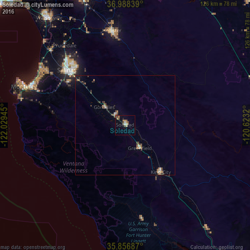
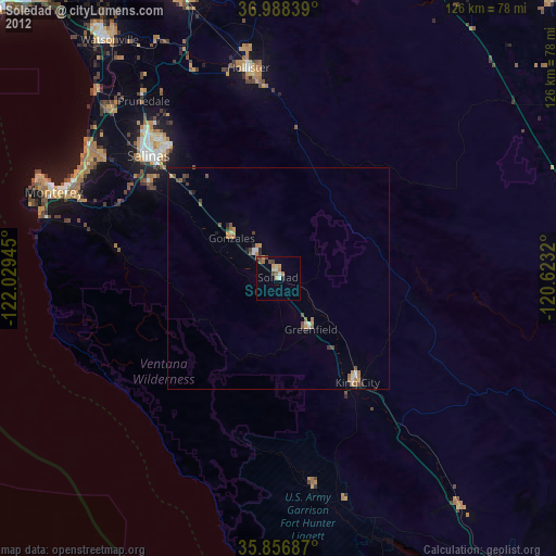
Analysis of Soledad night lights 2016
Square area 10x10 km:
 0.52%
0.52%90-99
1.05%80-89
1.22%70-79
3.15%60-69
1.05%50-59
2.1%40-49
3.85%30-39
0.35%20-29
0.7%10-19
2.45%0-9
83.57%Square area 50x50 km:
0.11%90-99
0.23%80-89
0.13%70-79
0.28%60-69
0.3%50-59
0.4%40-49
0.44%30-39
0.48%20-29
0.31%10-19
0.44%0-9
96.87%Clear (daylight) street map image can be seen on geolist.org.
Map coordinates:
36° 59' 18.2" North, 122° 1' 46" West
36° 25' 28.9" North, 121° 19' 34.8" West
35° 51' 24.7" North, 120° 37' 23.5" West
Some cities around Soledad sort by population:
• Salinas
40.7 km =25.3 mi,  313°
313°
• Hollister
48 km =29.8 mi,  351°
351°
• Seaside
51.3 km =31.9 mi,  293°
293°
• Marina
51.4 km =31.9 mi,  304°
304°
• Prunedale
49.6 km =30.8 mi,  321°
321°
• Greenfield
13.7 km =8.5 mi,  147°
147°
• King City
29.6 km =18.4 mi,  142°
142°
• Gonzales
13.9 km =8.6 mi, 310°
5397018 (p: 25,003)
Sources (retrieved 2019-11-25):
» Earth at Night: Flat Maps 2012, 2016