Coalinga night lights from space
Night Light of Coalinga (California) from space (United States) Src. Average luminocity for 10x10km area is 17.2143% and for 50x50km: 2.0738%.
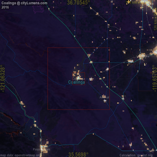
Analysis of Coalinga night lights 2016
Square area 10x10 km:
 0.37%
0.37%90-99
0.37%80-89
2.2%70-79
3.11%60-69
6.04%50-59
5.86%40-49
1.83%30-39
0.73%20-29
1.47%10-19
8.06%0-9
69.96%Square area 50x50 km:
0.12%90-99
0.1%80-89
0.08%70-79
0.45%60-69
0.52%50-59
0.5%40-49
0.41%30-39
0.42%20-29
0.21%10-19
0.48%0-9
96.71%Clear (daylight) street map image can be seen on geolist.org.
Map coordinates:
36° 42' 19.6" North, 121° 3' 47.8" West
36° 8' 22.8" North, 120° 21' 36.5" West
35° 34' 11.3" North, 119° 39' 25.3" West
Some cities around Coalinga sort by population:
• Hanford
67.4 km =41.9 mi,  71°
71°
• Paso Robles
64.4 km =40 mi,  207°
207°
• Lemoore
54.8 km =34.1 mi, 70°
• King City
69.2 km =43 mi,  276°
276°
• Avenal
25.7 km =16 mi,  125°
125°
• Mendota
68.3 km =42.4 mi,  358°
358°
• Lemoore Station
43.1 km =26.8 mi, 71°
• Huron
24.1 km =15 mi, 73°
5338196 (p: 16,564)
Sources (retrieved 2019-11-25):
» Earth at Night: Flat Maps 2012, 2016