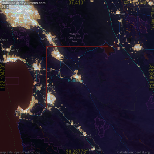
Hollister night lights from space
Night Light of Hollister (California) from space (United States) Src. Average luminocity for 10x10km area is 27.0487% and for 50x50km: 6.9434%.

Analysis of Hollister night lights 2016
Square area 10x10 km:
 1.14%
1.14%90-99
2.27%80-89
1.79%70-79
8.44%60-69
6.17%50-59
6.33%40-49
2.76%30-39
3.08%20-29
2.44%10-19
25.65%0-9
39.94%Square area 50x50 km:
0.95%90-99
0.96%80-89
0.55%70-79
1.18%60-69
1.14%50-59
0.74%40-49
0.76%30-39
1.15%20-29
1.93%10-19
5.38%0-9
85.27%Clear (daylight) street map image can be seen on geolist.org.
Map coordinates:
37° 24' 46.8" North, 122° 6' 17" West
36° 51' 8.8" North, 121° 24' 5.8" West
36° 17' 15.9" North, 120° 41' 54.5" West
Some cities around Hollister sort by population:
• Salinas
29.8 km =18.5 mi,  229°
229°
• Watsonville
32.2 km =20 mi,  281°
281°
• Gilroy
22.6 km =14 mi,  319°
319°
• Morgan Hill
38.2 km =23.7 mi, 324°
• Prunedale
25.3 km =15.7 mi,  250°
250°
• Interlaken
31.5 km =19.6 mi,  290°
290°
• San Martin
31.8 km =19.8 mi, 324°
• Castroville
33.2 km =20.6 mi, 253°
5357499 (p: 37,462)
Sources (retrieved 2019-11-25):
» Earth at Night: Flat Maps 2012, 2016